Day 7 Kernville and Tilly Creek

Our photos of Kernville are here Visiting Kernville
March 27 Friday

Even though I lived in Kernville back in the late 60’s, I barely recognized anything there. I tried to find the house along the river where I brought my newborn daughter in 1969, and while a house was there, it had been remodeled. I could only tell where I was by turning around and looking across the little park road to the river, where I recognized the view. The house I lived in before that in Lake Isabella nearby was also gone, covered over by a new 4 lane highway, south of the dam. It was still great being there, and remembering how life was when I had four little children under 6 and Melody was an infant in my arms. Time has a way of going by I guess, and I know that is a very trite, often repeated statement, but when you visit old haunts, words fail the feelings. It was good to go there and good to leave.

We camped in a lovely campground almost right in the town of Wofford Heights, Tilly Creek, on southwest side of Lake Isabella. The campground was nearly empty, but the caretaker told us that on the weekend to come, it was booked completely. It seems that there is a fishing derby, and 3 fish in the lake have been tagged with a 10,000 ticket. Catch that fish using specific gear from a specific sporting goods store and they double the prize. It was a bit daunting to imagine that lake covered with boats, all crazy for winning that 10K prize. We were really glad our timing was so good, even by accident. Note: don’t plan to camp anywhere near Lake Isabella on the first of April!

March 28, Saturday.

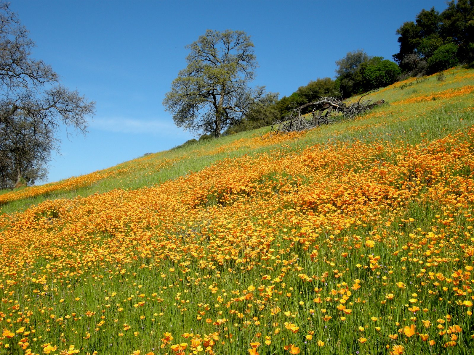
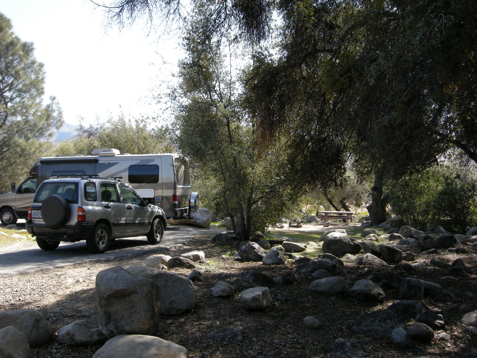
We left early in the morning, traveling east on 178 and north on the great road 395. I know that the Mother Road HWY 66 has its lore, but HWY 395 is truly a magical road leading from southern California cities, through the deserts, along the backside of the Sierras, through the edge of basin and range landscapes, through ancient calderas, new lava flows, huge lakes with no outlets, and wild country. I think there are more rock hounding sites on 395 than just about any road I know. Much of it is just 2 lane, and in some parts of Oregon, you won’t see another car for hours. Great road, but not so much in the winter. I have been in snowstorms on 395 going into Reno in May. You definitely need to plan and watch the weather if traveling that route.

Day 2 through 6 Wandering the desert

Saturday March 21
Route: south on I-5 to 138, hwy 14 to hwy 18
Photos are here at Picasa, Mo and the MoHo in the Desert

Digital Desert Mojave is a really great website for the Mojave Desert. If you plan on traveling there, it’s worth perusing at length. It is filled with detailed information about the landscape, rock formations, and documents the flow of bloom in the desert. After reading about the Antelope Valley Poppy Preserve and the promise of gorgeous displays, Mo decided to go there. It was a bit early in the season, but the photos show it can be lovely in spite of fewer flowers in full bloom. Another site along the way is Mormon Rocks, worth a stop and a look if you have the time.

Mo continued on to the southern entrance of Joshua Tree National Park. Arriving late on a Saturday afternoon meant that she was really lucky to get the very last campsite available in the Cottonwood Campground, and it took a bit of jockeying to fit the MoHo into that space, even at only 26 feet. When we got this rig, we were thinking that we wanted to be long enough to be comfortable, yet short enough for tight NP spaces.
On Sunday morning the weather was perfect for a day exploring Joshua Tree, enjoying the cholla and ocotillo gardens, and all the amazing granite formations. The park has several routes in and out, and Mo had to exit and then go back in on Hwy 62 to get to the Blackrock CG which is large with many available spaces on this spring Sunday evening. These camps have water only, so it isn’t exactly dry camping, but almost. The JOTR website is filled with information about routes, ecology, camping, and hiking information.

Monday morning Mo left the park, following historic route 66 a few miles before going north on Amboy road to Amboy, then north again to Kelso in the Mojave National Preserve. At Kelso there is a nice visitor center in the historic Depot, but Mo thought that perhaps the preserve wasn’t very old since there wasn’t a great deal of interpretive information in the area other than the depot. After a day of wandering, taking lots of flower photos, and enjoying the desert, Mo camped at the Sunrise Rock Roadside CG in the Preserve. It was again dry camping, with no water, but the hiking area was wonderful and Abby enjoyed the views as well.

Leaving the Preserve on Tuesday morning, Mo traveled north into Death Valley. The flower show was still minimal this far north, so she went on to Tecopa, checking out the hot springs and campground for future reference, and visiting the Dumont Dunes ATV site. After some more wandering,she headed for the Flying J at Barstow, hoping to repeat her boondocking experince from the previous Sunday. Once there, however, she was overwhelmed with the noise and huge number of trucks at this major desert crossroads, and decided instead to head for Kramer Junction at the intersection of 395 and 58. There is a huge solar generating station here that you can see for miles. After settling in for a pleasant evening at a great little wayside with other rv’rs, she discovered to her dismay that a sewage plant was nearby and little whiffs from the fragrant ponds made it less than pleasant.

On Wednesday, the 25th, with just one more day until our scheduled meeting, Mo headed back north on 395 to Inyokern to check out the active ghost town of Randsburg. There were many old buildings in use by small businesses making an attempt at survival in the tourist trade. Back south to Red Rock Canyon State Park and CG where the cliffs are lovely for hiking and climbing through the rocks and canyons.

Day 1 Wildflower journeys

Freedom. That is what it is all about. Springtime in California, snow in Oregon, a motorhome waiting in the driveway, and time. In the beginning of the trip, however, it was Mo who traveled alone. Unbound by the work world, she decided that it was time to find the wildflowers. we made plans for a long weekend, arranging to meet in Kernville, but before then, Mo traveled unfettered by schedules, free to wander the desert in search of the best wildflower shows, to find somewhere to park at night, to wake when she felt like it and wander off to another field of color the next day. That is what this RV’ing life is all about.
Friday March 20
Route: south on J-59, south on 99, south to I-5
The familiar bumpy route south of J-59 to Modesto gets tiresome, and it seems that no matter where we go, we follow this road. Abby hates the bumps as much as we do, but the poppy show was at its height all through the foothills on this route. Yellow fiddleneck was also prolific, and while fairly common, it still makes for a lovely show.

South to I-5 and once more rewarded with a sea of blue lupine stretching all the way from the interstate east to the foothills south of Bakersfield. It’s smart to find a place to “be” before too late in the afternoon and around 4pm the Flying J on the Grapevine at Frazier Park was a perfect place to boondock. Mo said that when she went to sleep after watching a lovely sunset, she was basically alone in the big lot. Morning found her surrounded by 5 other motorhomes who also knew about the great free parking on this major route to and from LA. When in need for a quick and easy night stop, if the truck noise isn’t too bothersome, it’s worth finding a Flying J.

John Day Country and home

The picasaweb link posted here is to an individual album that are part of this day’s story if you want to see additional photos. If you like, you can click on the link and see the entire album on Picasa. http://picasaweb.google.com/kyotesue/TravelingOregonToHome

Last night we traveled till we felt like stopping which put us at another Oregon State Park, Unity Lake SP. This place is truly a treasure, off the main track, maybe 3 miles from Unity on HWY 26. The park is small and quiet with large spaces along the lake, big pull through sites in the middle, shade from the typical desert locust trees, and no people. Admittedly, it was midweek, but still, midweek in August, and there was the camp host, another trailer next to him, a car camping family from England traveling the west, and a couple of small truck trailer combos down the way. There are probably more than 40 sites here, so the emptiness was a surprise. The cost was great as well, with water and 30 amp electric for only $17. I know it’s the desert, but it’s lovely, with sage and grasslands, and great views. The night was blessedly dark, not a single light or sound to mar the stillness, and the temperature dropped to 42 blessed degrees. I slept great!


We left this morning by 8, an easy start since we didn’t even have to unhook last night. Continuing west along HWY 26 we were surprised by the steep climbs and drops as we crossed the Blue Mountains toward John Day. I got my favorite thing while traveling, not another car in sight for miles at a time. Not far west of the sage country at Unity SP, we found 3 really nice campgrounds on the east side of Blue Mountain Pass, FS camps with no hookups, but open and lovely, shaded with a small creek. We thought it would be great to boondock for 3.50 a night with our pass in the FS camps, then drop down to Unity for a couple of nights of hookups to get ready for some more cheap boondocking. Someday.

I got my first view of the Strawberry Wilderness and Strawberry Mountain, an area I have heard of but never seen. The Oregon Trail passed through here and the interpretive viewpoint with the big covered wagon was a delight. The landscape is open and empty of people, with big ranches, irrigated alfalfa fields, all surrounded by thickly forested mountains and peaks. Truly lovely, and a great drive if you don’t mind the ups and downs. The Tow-Haul got a good workout on this part of the drive for sure. We stopped in John Day to visit the Kam Wah Chung State Heritage Site, location of some truly fascinating history about the Chinese immigrants who were part of the building of the west. In California we have visited several places that have a great deal of history involving the Chinese men who came here, without wives and families, to work incredibly hard and try to reap some benefit from the better economy here in the US compared to China at the time. My home is Jamestown is surrounded by huge areas that were hydraulically mined, mostly by Chinese, and Mo and I visited Isleton in the Delta last Spring, also developed mostly by Chinese. The exhibit in John Day brought all these parts and pieces together for the first time in a way that helped it all fit. It is an amazing story.

Leaving John Day we continued west to the John Day Fossil Beds. So many people seem to pass through this fascinating land without actually seeing it, so this time we made it a point to visit the visitor center at the Sheep Rock Unit. The visitor center has an amazing array of fossils that have been recovered from the 3 different areas of the National Monument, and the explanation and interpretation of the natural history there is magnificent. They even have the work area where paleontologists clean and catalogue and work with the fossils that is visible to visitors, with huge glass walls that allow you to watch the work in progress. The Miocene period is a repeating story in my soils work, and in most places I have mapped, there are interesting formations that are the result of the activity that occurred during this time, from 12 to 50 million years ago, give or take a weekend. Here in John Day, it was all about volcanics, as in the Sierra Nevada, and in the Columbia Basin. It was great seeing really beautiful artistic interpretations of all that was going on here while Table Mountain was being built in Jamestown, and while the diatomite in the Klamath Basin was forming, while the Latah Formation in Spokane was building. Great to see everything in perspective all at once somehow. I am so glad that we took the time to actually visit the visitor center. Just a little aside, while we were there, 3 German tourists arrived, and were taking many careful photos of the American flag flying against the very blue sky.
Our trip for the day ended back in home territory, at brother Roger and Nancy’s home in LaPine, Oregon. Nice to visit them, since they were unable to attend the gathering in Spokane. After a nice dinner out, we slept again to clear skies and cool temperatures in the low 40’s before we headed out home the last 100 miles or so to Rocky Point.

We both felt that it was a successful trip, with all the moving parts of the MoHo working fine, and both of us were glad to pull up into the driveway under the huge firs around Mo’s house and settle in to a few days of respite before I have to return to work in California.

Traveling through Idaho

Here is the Picasa web link for photos for today:
http://picasaweb.google.com/kyotesue/TravelingIdahoToOregon

Mo and I are watching the morning news, which of course is focused on the summer Olympics in Bejing. The brilliant morning sun is flowing in through the open screen door facing east. We are in the Hellsgate State Park on the Snake River on the western edge of Lewiston, Idaho. I used to camp at this park often when I was working in this area 30 years ago, and when I did craft shows here, the lovely Dogwood Festival, held every April. Sometimes the dogwoods were in full bloom, and other times it would snow, but this area is usually much warmer than the surrounding parts of Washington and Idaho, and Lewiston is known as the “Banana Belt”. We are just south of the confluence of the Clearwater and Snake Rivers, and the Clearwater is an amazing river coming from the Bitterroot Mountains, and much of this area is part of the Lewis and Clark Trail. Here at the park, there is a lovely Discovery Center that highlights the story of the famous pair as they traveled through this country. We will be heading east and south along HWY 95, traveling through Nez Perce country, passing the Nez Perce visitor center and perhaps a casino or two that wasn’t here in the days when I did the soil survey for these areas. The Nez Perce National Historic Park has several sites in this vicinity, and it is a great history lesson to view these areas with the stories that go with them.
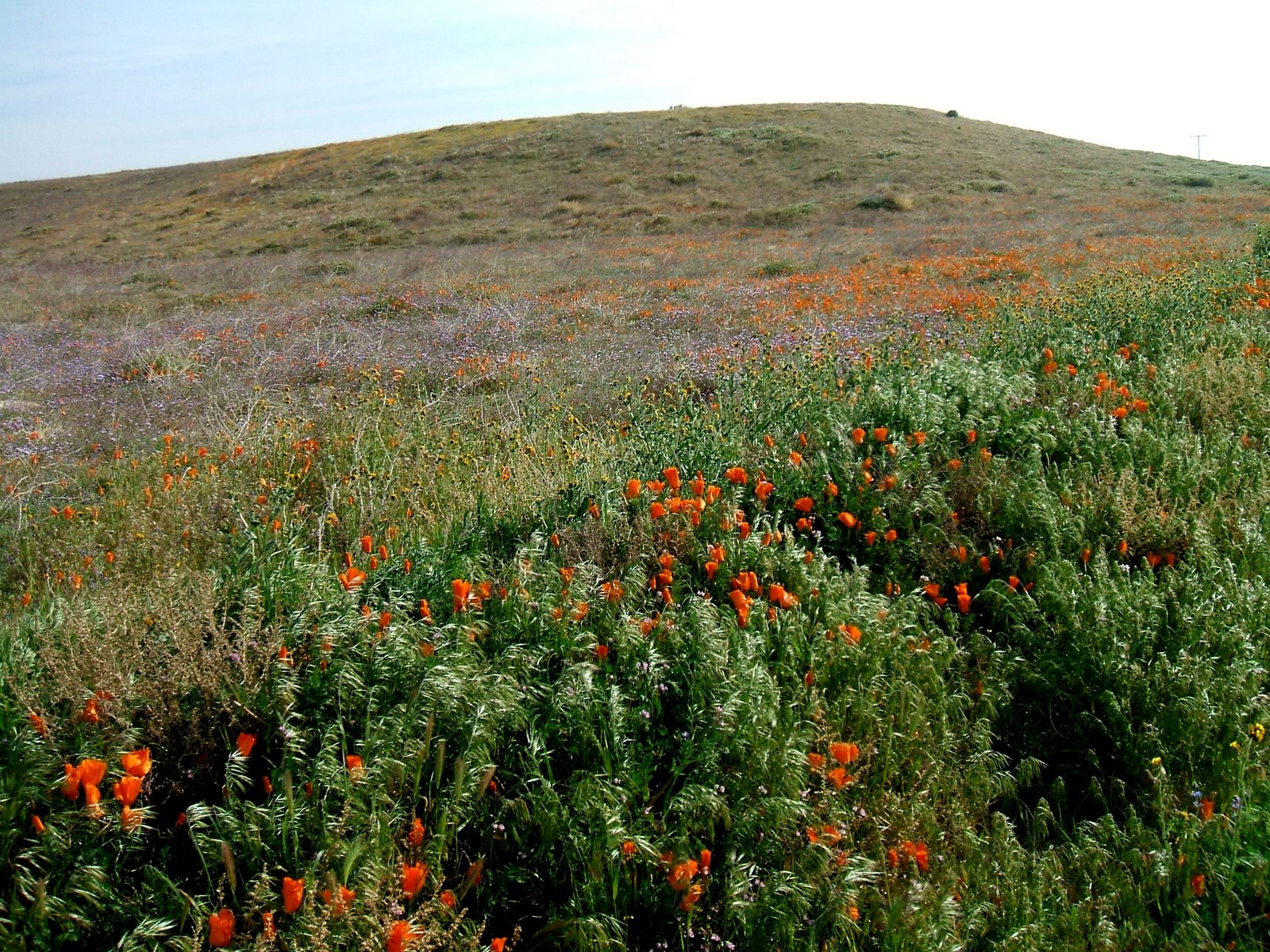
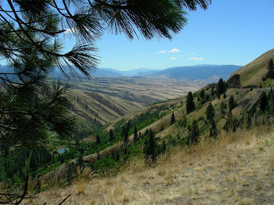
The photo is taken at the top of White Bird Hill, site of a famous battle involving the Nez Perce and Chief Joseph. http://www.nps.gov/nepe/

Its fun being here, recognizing all the landscapes and landforms, knowing the plants, the geology, the natural history. Sometimes when I am working in California I miss that intimate knowledge of an area that I developed over so many years working in the Idaho Panhandle. Technically we are out of the panhandle now that we came down the Lewiston Hill, once a winding steep road with many switchbacks, now a very long down grade of 7 percent that makes me very happy with the MoHo’s tow-haul feature that downshifts with just a slight touch of the brake. I lived here when the hill opened and the first weekend a semi hit one of the runaway truck ramps, and because it was unexpectedly frozen, the trucker was launched out over the 1000 foot hill to an unhappy end. Here is a great photo from the 1920’s of the original road which had 64 turns in less than 10 miles. http://www.idptv.state.id.us/buildingbig/hiways/lewistonhill.html

Our goal was this lovely park, full of big old maples that have been planted long enough ago to provide lovely shade, the Snake River out our window, electric and water, with a dump station and television reception with an antenna from Spokane. This is a place worth returning to, with so much around the area to explore, including a long lovely river walkway that goes for several miles along the Snake and the Clearwater. In a little while we will head south and plan to go through John Day in Oregon and then on to somewhere unknown for the night tonight before we head home tomorrow via Mo’s brother’s home in La Pine. We couldn’t ask for a better day to travel through this part of Idaho.