And no, it isn’t spelled “caribou” as in the animal.
 In the late afternoon shadows on Fraser Lake, we were serenaded by the haunting call of the north, the loon. I have heard their singular cries often on NatGeo specials, listened as some nature photographer captured the essence of wild northern lakes, but it is the first time I have seen a loon up close on the water. I couldn’t believe how big he was, and how very loud. He let us get within a few hundred feet while his mate stayed much father away from us. I didn’t see any little ones, but with the racket dad was making to draw us away from mom, I wouldn’t have been surprised if they were out there.
 The water was smooth when we launched, but turned rough and windy, so I was glad that I hadn’t brought the good camera. For now, the point and shoot is all I will take with me in the kayak unless I can be assured all is glassy smooth. When I heard the loon, I thought I could maybe get a video with sound, and snapped on the baby camera only to get the dreaded message, “Battery Exhausted”. Sigh. I had just put in the new battery before we went out in the boats, but with the power shifts and inverter on/off kind of thing, it somehow wasn’t fully charged. Yeah, I know, always carry a spare, and I did, in the motorhome. So no photo of the loon couple.
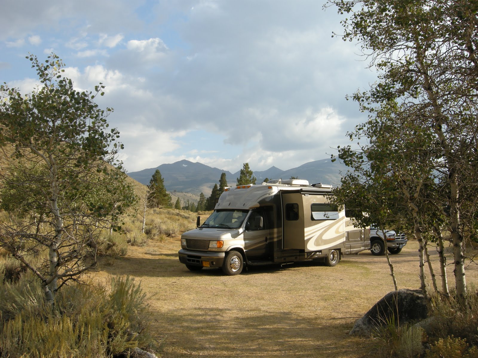
 It just started raining a bit ago, and the skies are heavy and dark. We are settled in quietly at Beaumont Provincial Park on Fraser Lake, about 86 miles west of Prince George on the
  Yellowhead Highway. We landed about 2:30, with plenty of time to take Abby for a swim and then go for a kayak on the lake before supper. I thought we might be entering the wilderness when we headed west from PG, but not so much. Evidently this string of lakes along the Yellowhead are popular with the local weekend RVing crowd, since there was a long line of rigs returning east on this Sunday afternoon. Lucky for us it was Sunday, since the park was almost empty and once again our no-reservation plan is working. Camping here along the lake is 16 Canadian dollars, for a spot and no hookups, but it is lovely.
Today was my turn to drive, and we actually got out of Clinton at 7:30 this morning, knowing we had a long driving day planned. I am sure there are sights to be seen along the Cariboo Highway, 97 north, the Gold Road as they call it, but we still are pushing to get north. I think now we are north enough to move a bit more slowly. The 335 miles that we logged today covered long straight miles of gorgeous road, much of it newly developed 4 lane highway, smooth as silk and no traffic at all. I am sure we are leaving all that silky road behind us before long, so I appreciated it a lot today.
 I lived in Prince George for a few months in 1973, and drove there in a very old car with my 4 babies on a long winter night in January. That is another long story that probably will never get told, but I couldn’t help comparing that drive to the one today in utter luxury. In those days I think the road must have been wilder and more terrifying, the wilderness was everywhere. My first taste of wilderness today was the sound of that loon.
 But this morning the sun was shining when we left Clinton. The one stop that drew us in was the Heritage Display at 108 Mile House. the information center and museum were still closed, but we did enjoy walking around the grounds and admiring the beautiful log buildings that have been so lovingly restored. The “houses” along the Cariboo Highway were developed during the gold rush and gave the weary miners safety, shelter, a bed and some food along the way north. Still called 100 Mile House, 133 Mile House, 150 Mile House, I’m glad they didn’t try to change the house to something or other Meter House!
 Since I was driving today, there are fewer photos, and the few times I really wanted to stop for some shots of the flooding Fraser River there absolutely wasn’t a single place to pull off. The Fraser is a magnificent river, draining the Fraser Plateau all the way to the Pacific Ocean, with a rich and wild history from the fur trappers to the present day. It was chocolate brown and angry today, filled to the banks from all the recent flooding in the northern part of BC, and carrying all sorts of logs and debris torn from the riverbanks. It was exciting just to see it.
We crossed the Quesnel River and the drove beside the Fraser through the cute little town of Quesnel. I remember when I lived in Prince George that I wished we could live in Quesnel. I had no desire to try to see anything in Prince George. My memories there weren’t especially good, and the town has quadrupled in size since those days. I was happy to just drive on the outskirts, hook up to Highway 16 and skip the whole thing. This is a trip about going north, about wilderness where we can find it, about silence and solitude and big landscapes, not about towns.
 The rain has stopped, Mo is reading while I write, and I am wondering how long the evening will stay light. Even with the dark overhanging clouds, I don’t expect darkness to fall anytime soon. We are glad for the light darkening shades that we have throughout the MoHo, and I think they will come in handy as we continue north.
 I don’t have an internet connection tonight, so can’t spend a lot of time looking up things like weather, sunset and sunrise times, or reading blogs and my only job is to write this piece and then drop into bed and try to remember what I was last reading on the Kindle. Actually, the Kindle remembers for me, good thing, since there are a lot of books that I loaded up before taking off on this journey and I haven’t had a moment to pick it up since we started.
Tomorrow: Smithers and on to the Cassiar Highway
 Miles traveled today: 335
The rest of the photos for this day are linked here.
")
")
")
")
")
")
")
")
")
")