3-21-2014 Advice From A Canyon

Lower Antelope C_144In spite of temperatures in the high 60’s, the sun is high and if not sheltered by some shade, feels white and hot as only high desert sun can feel.  The surrounding landscape reflects shades of salmon, not that bright red sockeye, but the pink Chinook slabs on ice in the fish case, pale and soft.  We are settled in for our last afternoon at the Page Lake Powell Campground, on the main road into the town of Page. 

It has been a good location and a good park for us to regroup a bit, pick up another month’s worth of mail sent by overnight express USPS general delivery.  “Overnight Delivery” in remote locations like this one often mean two overnights, but in our case it was three.  We planned for that possibility with a three day stay, and with delivery not as promised, will get our $19.99 refunded in full.  Good for us, too bad for the USPS.

It is amazing to me, that in all my years traveling around the Colorado Plateau, I never came to Page.  I did know that the Antelope Canyons, once called the Crack and the Corkscrew, were in the vicinity of Page.  I hiked slots all over Utah, and looked at photos of Antelope, but somehow the trip never happened.  It was a bucket list trip for me, one I knew I would have to someday experience.

I can’t help wishing I had done it prior to the 1997 tragic death of 11 canyon hikers in a flash flood.  A Navajo permit was always a requirement, but now non native folks are not allowed in the canyons without a Navajo guide.  Our decision to travel through Page was Mo’s suggestion, and took my breath away.  Yes.  Lower Antelope C_161

The minute we arrived, the young man at the campground desk called their favorite tour group for me, Antelope Canyon Tours.  All photographic tours for the next several days fully booked.  All prime tours for the next several days fully booked.  “Prime” means a tour during the magical light hours of 11AM and 2PM, when the sun shines into the canyon forming the famous light beam that folks come from all over the world to photograph.

DSC_0036With a bit more conversation, after he realized that I was a party of one, (Mo declined this part of the canyon), he called the company again and they found room for me on an 11:30 AM tour for Upper Antelope Canyon.

Visiting Lower Antelope Canyon is completely different.  Entrance to this part of Antelope is administered by a single family, and no reservation is needed at the current time.  You simply show up, pay the $26.00 fee (including the 6.00 tribal fee) and wait for a guide to take your group through the canyon.

I was so excited, and actually nervous on the morning before my Upper Canyon tour.  I knew that it would be crowded, and that the lighting conditions were challenging.  I thought that even though I wasn’t on the photographic tour that I could still take my tripod and read extensively the night before about tips for shooting the famous colors and light in the canyon.

Antelope Canyon Tours uses open 4 wheel drive jeep type wagons that hold 12 people in the back.  They picked me  up at the campground, a free service, and took me back to town where I joined the several dozen people waiting to leave on the 11:30 tour.  I was told then, that without being part of the official photographic tour, I could not take my tripod. 

CaptureWith f8 and f11 being the sweet spot and shutter speeds of more than a minute in some cases, I knew I was doomed.  I thought well, ok, it doesn’t matter really.  I am not coming to this canyon because I want to take pictures, I am coming to this canyon to be IN this canyon, so took off the tripod and accepted that my photos would be personal reminders and not technical perfection.  I set the ISO really high and went for it.

DSC_0067All the photos in the world, no matter how many times you see them, will not give you a clue of what it is like to be here.  All the crowds, all the rushing through of group after group, the clicking shutters, the calls of the guides trying to get people out of the way as the next group comes through, not one bit of this interferes with the amazing visual experience of walking through these canyons.

I found myself slipping into a meditative state, trying to be in the moment as much as possible while I also tried to change camera settings and frame and shoot.  It was a test, a spiritual test, I am sure. Of course I would love to walk alone at my own pace through this sacred space created by time and wind and water.  Me and a whole lot of other people, I am sure. Some precious places in the world simply require humans to accept that there are other humans around who want to experience them as well.

The trip from town to the canyons takes about 20 minutes or so, with much of it in Antelope Wash on thick soft sand.  It is dusty.  It is rough.  Of all the people on the tour with me, not one spoke English.  I was treated to the sounds of German, French, Japanese, something I am pretty sure was Czech, and several languages I didn’t recognize.  This is a very popular place and people from all over the world make the journey to Page, Arizona, to experience these magical slot canyons.

DSC_0076We were in the canyon just a little over an hour before we were herded back into the trucks and I was dropped off at my campground on the way to town.  I think my hair was stiff with dust and my face streaked from the dust and the happy tears that kept falling as I walked through the canyon.  Dumb.  The place just made my eyes water.

I was so happy that the next day I had another chance to be in an Antelope slot.  Mo and I woke early, and were on the road toward Lower Antelope Canyon a little after 8.  With tours beginning at 8:30, when we arrived there were already many people waiting.  We paid our money and within a minute were in line with our Navajo tour guide. 

Photos I had seen of this canyon showed people entering through the narrow slit in the earth from above, but our entry was on the south side of the canyon down many flights of steep stairs, but wasn’t difficult at all.  The narrow entrance shown in many images of Lower Antelope Canyon is now the exit, or at least for this day it was.

Entering once again into the reflected light of Navajo sandstone was thrilling, and this time Mo got to see it as well. Mo is a bit less excitable than I am, so I was happy to see her eyes widen in delight as we descended into the canyon.  Our tour group once again had people from all over the world, and included several small children, and even folks packing babies in carriers.  I was glad that all I had to carry was my camera!Lower Antelope C_001

Once again, the canyon light was breathtaking.  The morning sun was in the perfect position to reflect and bounce light around the swirling walls in ways that direct lighting could not do.  Our young guide was great, managing all the people gently, and yet still taking my camera for some shots that he didn’t want me to miss. 

Lower Antelope C_154Lower Antelope C_015Lower Antelope Canyon is a completely different experience than the Upper Canyon.  The floor of the Lower canyon is more narrow and the upper part is wider, allowing more light to enter and more bounce.  While orange and shades of salmon are common, in the lower canyon the purples and golden shades seemed to show up in the images more dramatically.  Looking at the sandstone up close, it is all the same soft pale salmon color, but all the color in the imagery is about the light and how it is reflected and bounced around the complex walls of the canyon.

As with any kind of photography, settings make all the difference, with the camera seeing things the eye cannot.  The eye and the soul however, working together in the canyons, can see and feel things the camera will never capture.  All the techniques and tripods and equipment and time in the world can’t capture what it feels like to walk in either canyon.  It is a life time, don’t miss it if you can help it, kind of experience.  Lower Antelope C_060

This afternoon, sifting through the hundreds of images of swirling color, I thought of Erin a lot. Her photos of icebergs in Greenland must have been similar.  Frame after frame of shape and color and light and shadow are so incredibly seductive.  Blue water frozen in place and reflecting light and pale sand frozen in time and sculpted by water, reflecting light, somehow the same. Lower Antelope C_188
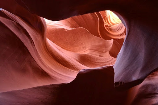
I could happily drown in this frozen sand filled with light.

If you want to get lost in the pictures as well, the Jpegs will be posted to a google album in the next few days. Check the link on the upper left side of this blog.  Finer resolution photos will be waiting till I get back home.Lower Antelope C_041
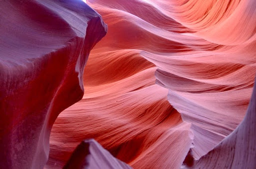
I will close with the “Advice from a Canyon”, from a sweat shirt I bought at Chaco Canyon:

Carve Out a Place for Yourself

Aspire to New Plateaus

Listen to the Voice of the Wind

Don’t get Boxed In

Stand the Test of Time

It’s OK to be a Little Off the Wall

Reach Deep!

1-10-2014 Big Bend part 1

Current location: Corpus Christi NAS with 53 degrees F and 18 mph winds at 4am

back to camp after a long day in Big BendI am sitting here this morning, listening to the winds buffeting the MoHo.  At 3, we were wakened by the gas alarm going off indicating our power was down.  I stepped outside to check, and everything seemed fine, with dim park lights here and there.  I discovered that the wind had blown the power cord right out of the receptacle.  Fixed it with a bungie and came back to bed after turning the power back to “store”. 

Of course, the moon is almost full and reflecting off the water of Corpus Christi Bay, a rather amazing sight.  There are also 8 to 10 foot fountains of sea spray that are illuminated by the moonlight.  I felt the spray blowing this way when I went outside. We were warned about the sea spray and winds when we took this site on the edge of the park near the water.  It is worth it for the view and the open spaciousness of the site.

map to big bend 197 milesMo and I looked at each other in amazement as we ate our supper last night.  It is rather incredible to go from the wild hot dry angular desert to the flat water filled landscape around us here west of Corpus Christi.  Just one day of driving, and here we are. 

But that isn’t supposed to be the subject of this post.  I need to write about Big Bend, and let myself slip back from this moonlit sea spray filled morning to the warmth of the desert we left behind.  I couldn’t sleep after the wind woke me up, and it was as much from the weight of the Big Bend writing waiting in my head as it was from the sound of the wind. So let’s slip back a bit to a few days ago when we first entered the amazing world of the Big Bend of the Rio Grande.

The sun was brilliant and the temperatures perfect when we left Davis Mountains State Park.  In the cool of the morning, I wanted to get a few more photos of “downtown” Fort Davis, and in the process ran into a delightful gentleman, Jim, who was working for the county at the lovely courthouse, pruning some trees.  We engaged in some conversation, and he told me more about the horrible fire that blew through here in 2011.  He also told me that I shouldn’t go to Big Bend through Alpine as we had planned, but should go south on highway 67 to Presidio and travel the River Road east through Big Bend Ranch State Park.

Highway 170 the River RoadMBZ had warned us that Presidio was a bit dicey, and I asked Jim about this, and he said, just don’t go into Mexico and don’t stop anywhere.  Ok then.  Trouble is, once we got to Presidio, the phone thought I was in Mexico and decided to stop sending me data for the maps.  I had a paper map, but it was a bit worthless for actually seeing the proper turns, and suddenly the big entry into Mexico loomed up ahead, and I hollered, “Turn around NOW!” For some reason, I had completely forgotten the Garmin tucked under the seat.  Duh.  When the phones don’t work and the paper maps are too small in scale, the Garmin is quite helpful.  Trucker Deanna always says, “Mom, we use all three all the time, phones, paper maps and GPS”. Of course. We managed to avoid getting in the entry line and turned around to find our proper turn east on Texas Farm Road 170.

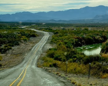
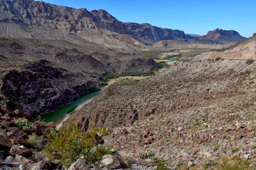
Highway 170 the River RoadFarm Road 170 meanders along the Rio Grande through another wild and untamed gem of this part of Texas, Big Bend Ranch State Park.  We had no time to hang around here, but definitely enjoyed the dramatic views along the route, especially the deep canyons of the Rio Grande near the one rather serious “Big Hill”.  The hill isn’t marked except for a sign about 15 miles west of it that says, “warning 15 percent grade 15 miles ahead”.

ready for the 15 percent downhill on Highway 170 the River RoadFollowing the river for miles and miles, it is easy to see that the international boundary is often just a mental concept.  Here there are no fences and we didn’t see much evidence of Border Patrol in this area.  The road winds and meanders, but wasn’t difficult for our rig, although the big hill was just a little bit hair raising, and thankfully quite short.  The rock formations at the Hoodoos were beautiful, and the geology was fascinating.

We drove east into the town of Terlingua, later wishing that we had taken more time to explore it a bit, but we were intent on getting to our campsite on the far side of the park. We missed a four star attraction listed in our guidebook, the historic Starlight Theater at Terlingua, restored as a restaurant.  We won’t make the same mistake again. MBZ had warned us about this, suggesting that we spend time on BOTH sides of the park, and next time we will definitely do that.  And yes, there WILL be a next time.

the Chisos MountainsOnce we entered the park, the beautiful range of the Chisos Mountains dominated the landscape, but the route is mainly through the desert.  Unlike the Sonoran deserts around Arizona, the Chihuahuan desert seems to have a lot more vegetation, with thick grasses between the prickly pear and creosote.  The Chihuahuan Desert is the largest desert in the Americas, extending almost to Mexico City.  Creosote and agave are the main indicator plants and there are several species of prickly pear and yucca.  I saw not a sign of a saguaro, so common in the Sonoran Desert around Tucson.  Most of the moisture comes as summer rains, with a bit more precipitation than in the Sonoran as well.Chihuahuan-Desert-map

Panther Junction (at the intersection of the main park road 118 and road 395 east to Marathon) is about 20 miles west of Rio Grande Village, and is the location of an excellent visitor center.  As always, we stopped at the visitor center for maps, orientation, and information about the park.  There are some excellent displays, a good selection of natural history books and park guides to help us begin to understand this beautiful, remote area.  My favorite, the 3D landscape map, was big and very helpful with orientation.  I find that these maps are a bit less needed in the days of google earth, however, since I now can cruise an area in 3D on the internet and the imagery is a bit more detailed.  Still, I love that the parks have these big map models.

Rio Grande Village RV Park with full hookupsWe arrived at our campground early enough in the afternoon that we had time to do a bit of exploring around this far eastern edge of the park.  As we knew, there are no dogs allowed anywhere except on pavement or dirt roads that can accommodate a car.  Still, it was hard to realize that we couldn’t leave Abby behind in the rig, or leave her in the car while we hiked.  Just wouldn’t do.  Instead, we planned our explorations around unpaved road trips and a few short hikes.

There are two campgrounds at Rio Grand Village, with the national park campground with campsites without hookups, potable water at the entrance and a dump station.  There is a large no generator zone, and a nice area with sites big enough for large rigs and where generators are allowed at certain hours. 

Rio Grande Village in Big Bend NPBecause we had no idea of the weather conditions for this trip, we opted instead for the Rio Grande Village RV park, basically a pavement parking lot with full hookups and WiFi from the small store and laundry.  Gasoline and diesel are also available, and we were surprised at the reasonable cost for regular at only 3.65 per gallon. We have been in national parks where the prices are two bucks or more higher than the going local rate, so this was nice. We had no need to fill the rig since we had fueled up enough to take us through the park and back out, but we definitely needed gas for the baby car to fuel our off highway adventures.

Our first little trip took us just a few miles from the campground to Boquillas Canyon where there was a rest room at the parking lot and a sign marking the trailhead.  It is just a little over a mile to the canyon, but the trail is “easy” if you ignore the rather steep and rocky ups and downs on the first part of the trail.  I was glad for boots instead of Oofos, and those Keen Targha waterproof hiking shoes are a godsend. Boquillas Canyon trail

Mo generously  decided to wait in the parking lot with Abby while I did the hike, a decision she made a few more times while we were in Big Bend.  Next time we come to this place, if our animals are still with us, we will board them in Alpine, the closest center where there is a pet boarding facility.

leave your dollars and support the schools of Boquillas?

The Boquillas Crossing used to be a port of entry from Mexico, but after 9/11 the DHS closed it, along with all other small ports of entry in the park.  You can see the little town across the river, and at the river overlook we found displays of beaded trinkets with cans requesting $6. per item for little scorpions and for painted walking sticks.  Wherever we found the signs, the request was for money to support Boquillas schools.  We chose not to buy, and yet I did think about it, even though the park insists this is completely illegal and they will arrest you if you buy and confiscate your contraband. 

Below us, across the river, there were boats tied up and some horses resting under the trees, and someone called up to me as we stood there but I couldn’t understand him.  His voice sounded friendly, though, and I am sure he was entreating me to buy something.waiting for cover of night to come and get their money?:

As I hiked up the trail, I found a few more of these little stashes, and at the entrance to the canyon, I saw a canoe hidden in the rocks on the Mexico side of the Rio Grande.  Higher on the trail, looking down below to the river, I saw a man on a horse, and the trail, steep and rocky as it was, actually had horse prints and horse poop on it.  Why do horses get to poop on trails and dogs are not even allowed to go there on a leash with a loyal pooper scooper in tow? I’ll bet anything that guy was from Mexico and had managed to cross the river somewhere to check his little can stashes.

The entrance to Boquillas Canyon was dim, hard to photograph in the late afternoon light, but it was silent and beautiful, with walls rising more than 1,200 feet above me.  I love tall, tight canyons, love how they feel, and found out later that this canyon is one on a list of possible river runs that I would love to do someday.  Probably not in my own kayak, however, since there are some rocky rapids that need a good river guide to navigate.  Still, it is on the bucket list along with Santa Elena Canyon.  That is tomorrow’s story, however. Boquillas Canyon trail

When I got back to the car, Mo and Abby were contented enough, and we did figure out that we should have a book or two in the car for Mo while I wandered about.  Mo and Abby go their exercise by doing six laps around the parking lot. One of the greatest little treasures that we found at the visitor center was a small book called “The Big Bend Guide” by Allan Kimball.  We loved this little book, a great find for first time visitors, with down to earth explanations of the local routes, and what to do if you have only one day or three days or a week in the park.  I highly recommend this book if you have never visited Big Bend.

vWe drove back to the main road, and then again turned off on a dirt high clearance road to find the Hot Springs.  The road is only about a mile and a half to the parking area, and we had hoped that maybe there wasn’t anyone around so we could possibly explore with Abby.  Instead, this was a very popular spot and there were several cars parked and lots of folks heading to and from the springs.

The area was once a large hot springs resort, with a bath house, motel rooms, and even a store and post office.  The abandoned buildings and old palms only hinted at what a delightful place this might have been at one time.  The sun was down, and the evening was cool in the twilight, so Mo decided to leave Abby for a short time while we walked the short distance to the springs.

hot springs at Big BendThe springs are 105 degrees F, in a small rock pool built along the Rio Grande, and look quite nice.  However, when we arrived, they were filled with a couple of families, kids all happily playing and moms floating au naturel in the hot water.  I really didn’t want to jump in with them, so I decided to wait for another time for a dip in the springs. 

We ran into this multiple family again a couple of times, with Alaska plates on their RV.  There were a LOT of people in that rig, but when we talked to them we found out that they were from Austin and had rented the RV.  They were having great fun together, although a motorhome with 4 adults and 4 little kids might be a bit much.  Whew!

rock art at the hot springsWe were happy to get back to our rig and eat the good supper of leftovers from our previous dinner.  So nice not to have to cook when it is dark and we have had a very long day! With no telephone, but at least enough Wi-Fi to get some mail, we settled in and read all the literature we had about what we might want to do on our next full day in the park. 

Big Bend is an International Night Sky park, with a commitment to keeping things dark and unpolluted with light.  There are lots of references to seeing the Milky Way here, but our moon was already too bright and while the stars were wonderful, that gorgeous view of the Milky Way eluded me.  I even got up in the middle of the night to check out the sky.  Maybe it was because the elevation at the Rio Grande is about 1,800 feet and perhaps those great Milky Way views are at the much higher Chisos Basin.hot springs at Big Bend

Still, even in our small parking lot camp, the skies were dark and the night was silent except for some low voiced owls here and there.  Loved it.

Tomorrow we travel the Scenic Route and find the magnificent Santa Elena Canyon