Day 2 Visiting Bodie


Photos of Bodie are here:

Deciding on an early breakfast of coffee and little powdered sugar baby donuts, we planned an early start for our adventure to Bodie. We gassed up in Bridgeport, at 3.99 per gallon for regular gas, in the midst of motorcycle rallies, a big rodeo, art shows on the courthouse lawn, and general busy-ness. Once we left Bridgeport, however, things quieted down again, even on 395. The road to Bodie from the highway is only 13 miles, 10 of it paved, and was a bit curvy but not a problem at all.

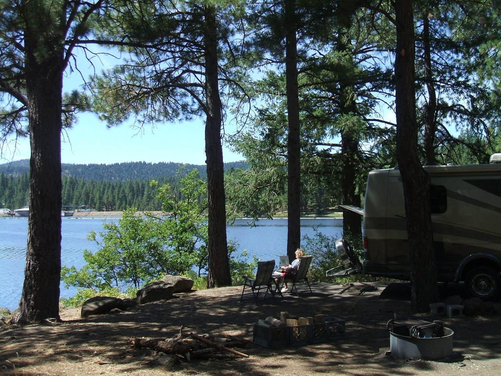
We have often traveled past the HWY 270 sign to Bodie, thinking we should go there, and for one reason or another never made it. Initially we thought we might boondock along this road, after receiving some correspondence from the BLM saying it was ok to do so. But even though there were some possible wide places in the road, it still is much less private and at this time of year we wouldn’t be able to have a fire in the evening, which we can do back at our forest service campground.

Bodie was wonderful, and a bit sad. I first saw this piece of old western history in 1971 when my children were small, and there were no people around then, and no fees. Today it costs 5 bucks per person to enter the park, with an extra 2 bucks for a really nice self guided tour book, well worth the price. We wandered the town with lots of other people, marveling at the history, and the fact that Main Street was once a mile long bordered on both sides by buildings, bars, hotels, and restaurants.

I haven’t included any more photos of the town because they are all so interesting that it is impossible to choose particular photos that really catch the feeling of the place. At one time Bodie boasted 10,000 people and 68 bars. The state of California has managed to preserve things as they were left when the town finally gave up in the 1930’s in a way that doesn’t detract from the originality and mood of what it must have been like to live there. Even so, Bodie is now one of the State Parks of California scheduled to close because of California’s budget woes. It would be a truly sad thing to lose this place to vandals and such because of the state’s management by crisis and focus on so many things of less importance than maintaining some of our history. There is no other ghost town that I know of in the west that is quite like this one.

Rumor was going around that the state also planned to sell off the artifacts on EBay to make money. Reading about the “Bodie Curse” befalling anyone who took even a rock or a plant from the place makes me wonder what would happen to those buying artifacts from Bodie!

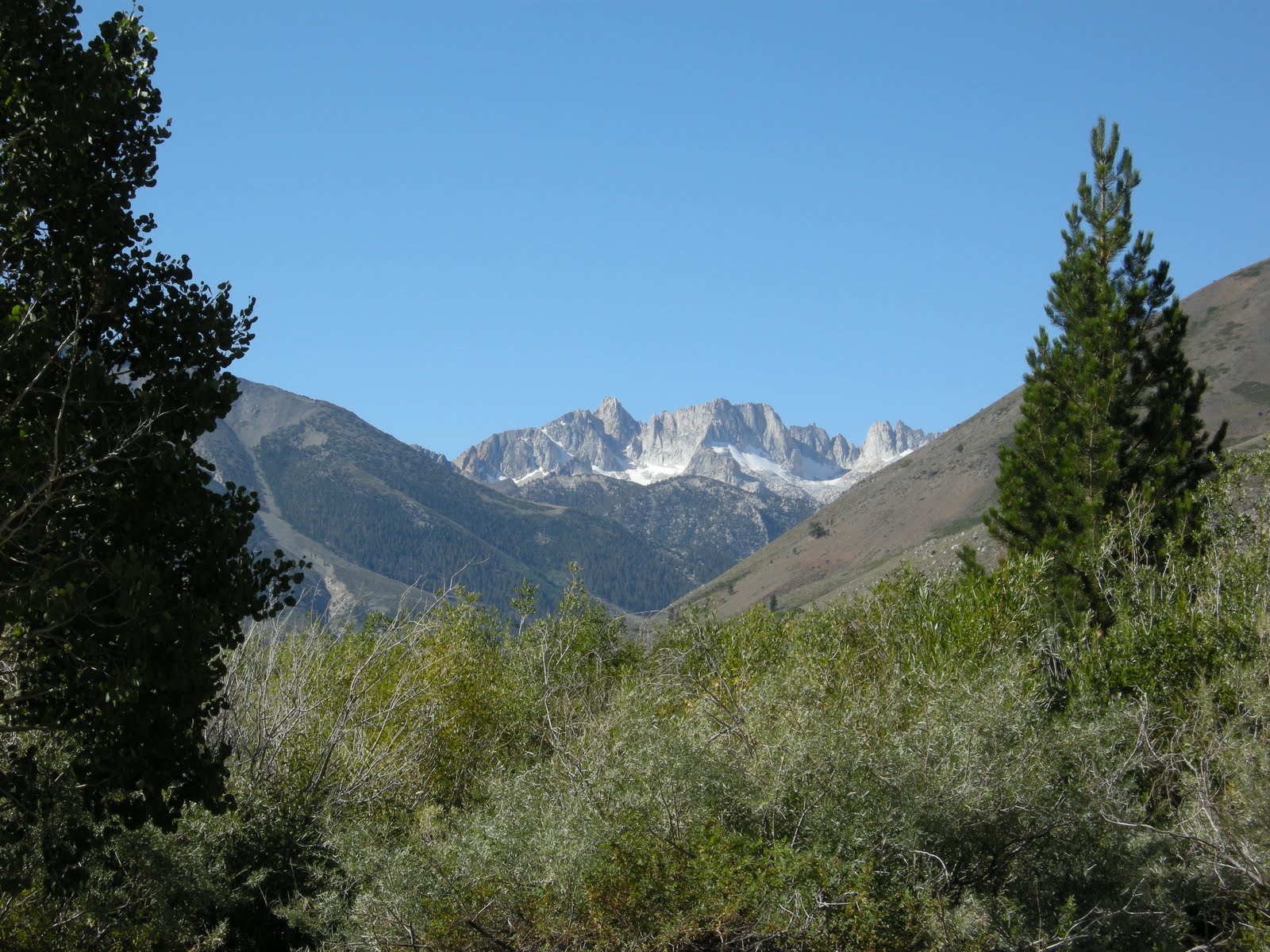
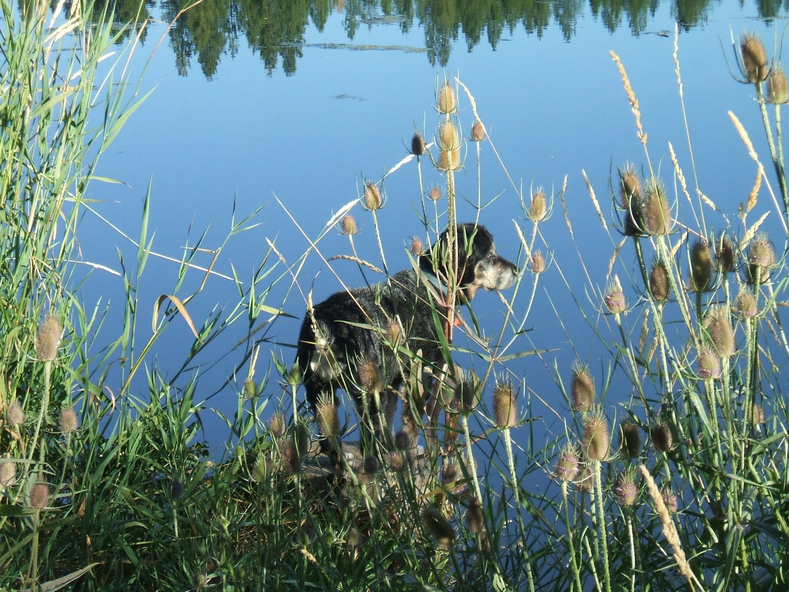
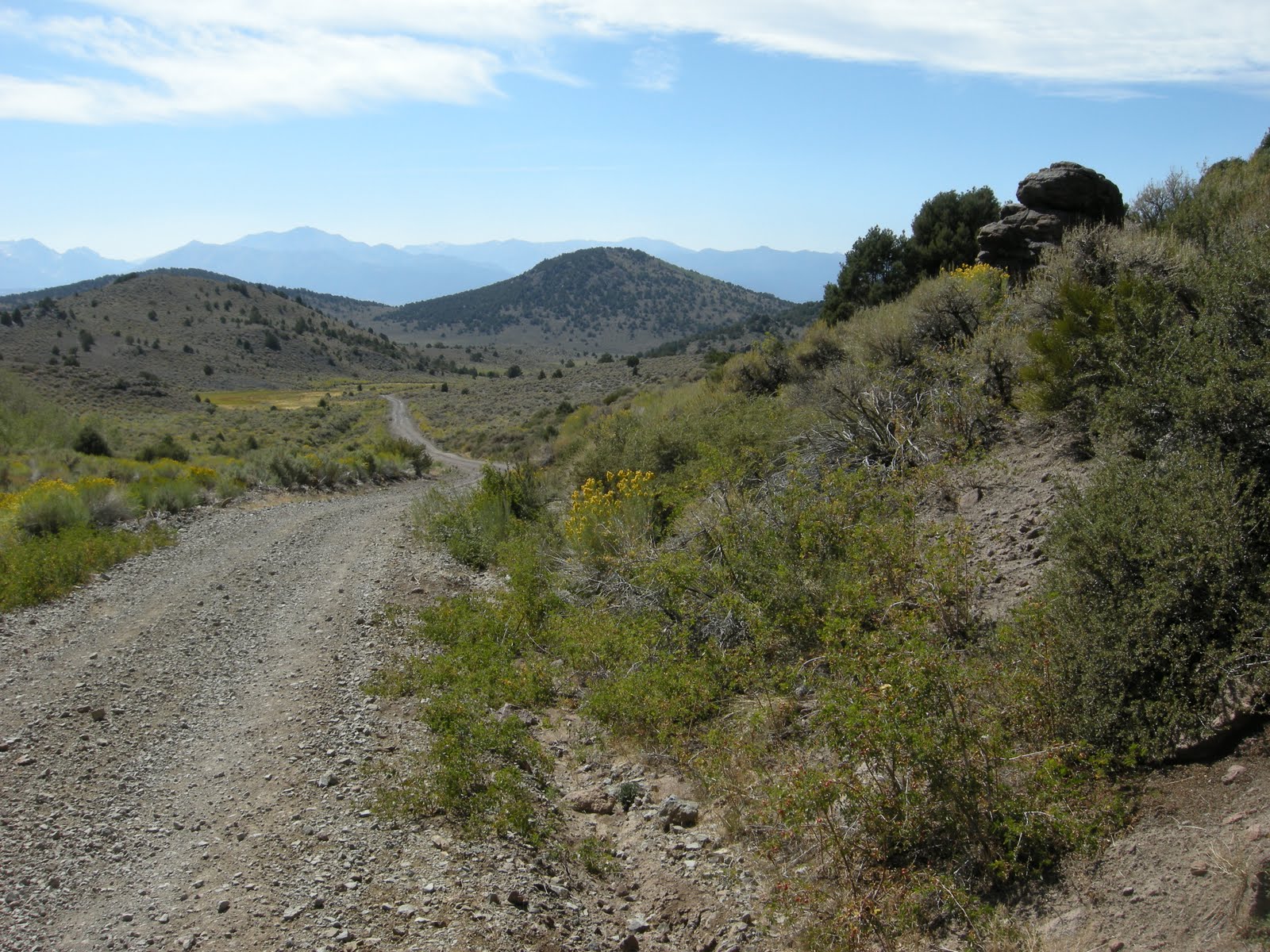
We left the busy parking lot and dusty road to return to Bridgeport following the back way through the Bodie hills, with views of the Sierra’s and the desert of Nevada to the west. Found a great little spot near a spring for a picnic lunch, where once more my trusty sleeping bag served us well, providing nice comfort on the hard ground. Abby loved it. We then wound down Aurora Canyon back into Bridgeport.

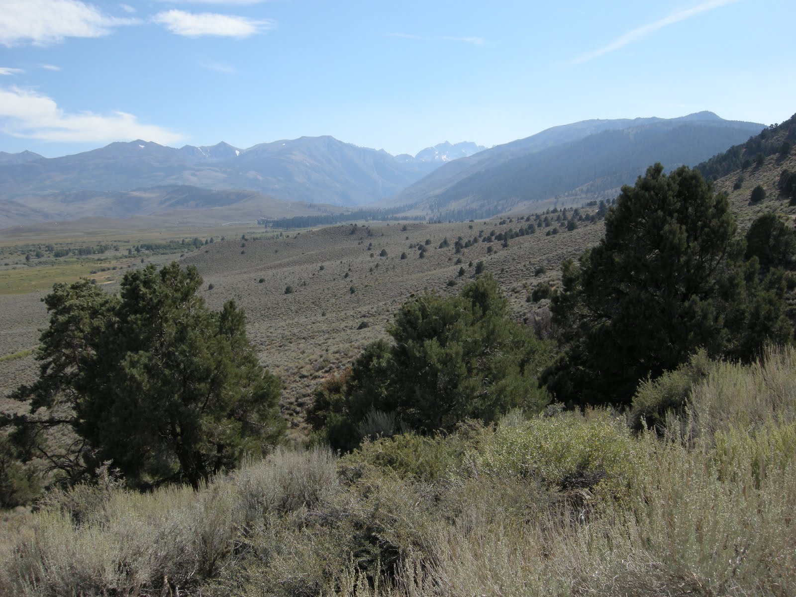
Tracking another backway, we took the Buckeye road from just west of Bridgeport along the base of the mountains with fabulous views of the Bridgeport Valley. This valley is one of the most extensive wetland valleys I have seen outside of Klamath, and there were literally thousands of cattle grazing on the lush grass.

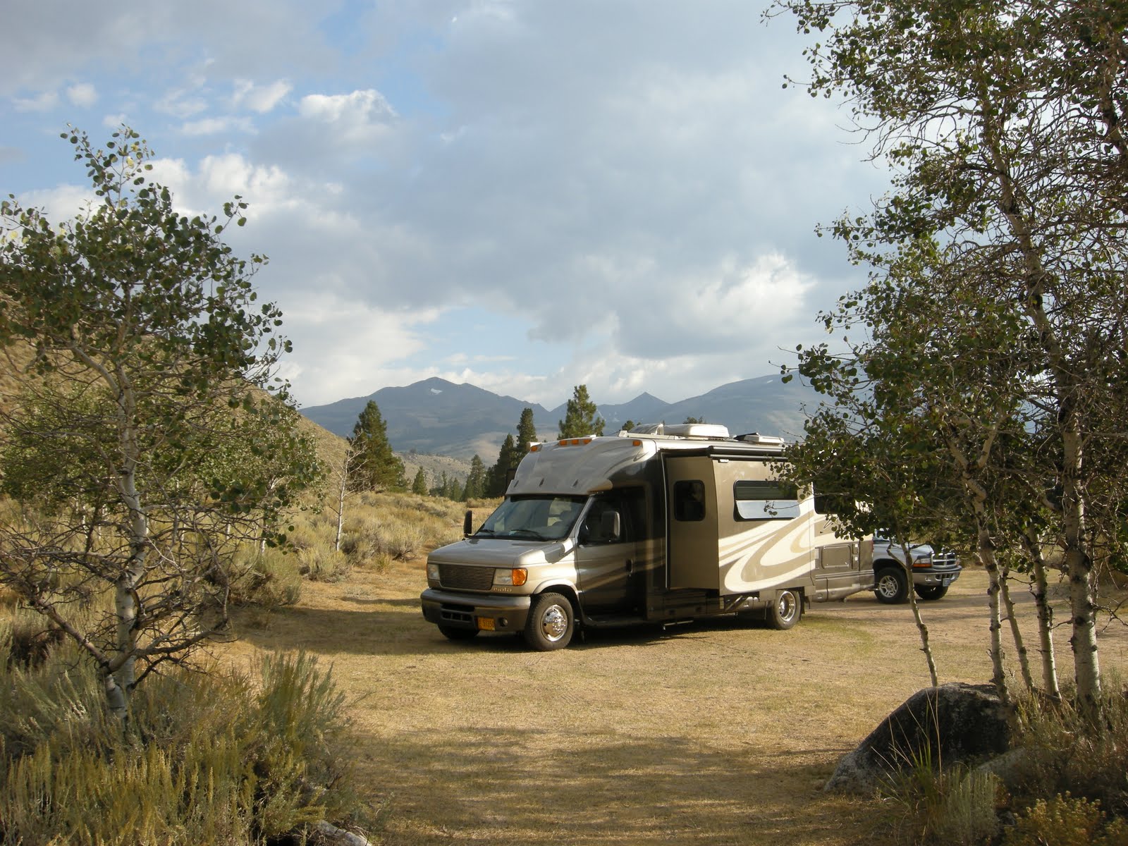
We got another perspective of the valley by taking the Buckeye road south from 395 into Twin Lakes area. Beautiful! The Buckeye campground is back from this dirt access road another mile or so and can be a bit rough. We probably wouldn’t want to take the MoHo there, but did see some bigger rigs camped, and even some empty spaces available on this Holiday weekend Saturday. In addition, at the crossroads on Buckeye road is the Buckeye spring, which was filled with people the day we passed so we chose not to go there. It is a “clothing optional” spring on the side of the hills above the creek. I plan to check it out someday, but probably not on a weekend!

Backway photos are here:

Day 1 Labor Day on the East Side of the Sierra

Mo and I decided that we really wanted to get to the back side of the Sierra’s one more time before I move home to Oregon permanently. The great part of this plan for me was the fact that Sonora Pass, HWY 108, is still open and my trip to Bridgeport took just a little over 2 hours compared to Mo’s 8 hour journey from Klamath via HWY 395.
I got to Bridgeport around 11:30 , so had a little time before our 1PM meeting arrangement to go find a campsite for us. Again, it is a holiday weekend, and for some reason we seem to plan these spontaneously, without making reservations. There are more than half a dozen campgrounds along the Robinson River leading up to Twin Lakes. Humbolt-ToiyabeNF Camping. We thought at least some of the campsites were still available on a first-come-first-served basis, but very few were still open when I arrived on Friday morning. I drove around a few of the campgrounds, and realized that I was lucky to find a very open, somewhat exposed site in Honeymoon Flat Campground, so I grabbed it, put down an old sleeping bag that was in the back of my truck so it would appear taken, and drove back to Bridgeport.
Mo arrived on time, and we set up camp and decided to explore our little valley, discovering in the process that we really had the best site of all. Even though it is open, without much shade, there are aspens around fluttering in the breezes, the sites are huge, and somehow sitting in camp, we see no one at all. Parking my truck perpendicular to the MoHo between the table and firepit made for a perfect little home that felt just right. We watched the sunset on the Sawtooth Ridge and the Matterhorn over Twin Lakes to the south.

The night temperature was perfect, down to 41, with a full moon and the MoHo stayed warm enough for comfortable sleeping without any extra heat, dropping just to the 50’s by morning.

I suppose the only drawback was the holiday traffic on Twin lakes Road, but with the sound of the wind and the noisy creek it all blended together eventually.

Camping at Topsy

The Klamath River winds in lazy arcs south from Klamath Falls through wide agricultural fields, but as it approaches the California state line, the canyons begin to close and the river becomes a torrent once again. Above this wild river, however, there are several dams, some involved in the controversy over fish, both salmon and suckers, farmers, and water. Topsy is one of the dams that may or may not be removed, but in the mean time, there is a delightful little campground along the eastern shore managed by the BLM.

Mo and I thought a short overnighter in the MoHo would be fun, so we drove about an hour from home to camp. It was the first time I had been on this part of the Klamath and I look forward to exploring it all a bit more someday. But for the time being, a simple overnight with a nice wide clean space on the lake’s edge, a great campfire, and a lovely cool morning hike was just perfect.

The pelicans are part of the Klamath basin, and this year it seems that there are more than usual. Kayaking Pelican Bay on the lake later in the week allowed us to slip in among some very large groups of juvenile birds, but on that day I didn’t take my camera. Here at Topsy, there were pelicans and ducks, several blue herons, ospreys, and other birds that I didn’t identify. The birdsong was great.

In spite of the heat, Abby was the only one who really cared to get into the green water. Because of all that farmland, or maybe because the water comes from the rich food source called Klamath Lake, there was a lot of algae and duckweed in the water. Abby swam and we lounged around in the late afternoon in the shade of huge ponderosas doing nothing. Nothing is really very nice sometimes!

Day 4 Rogue-Umpqua Highway and Susan Creek Campground

We woke up Wednesday morning to fog and clouds on the coast, making it perfect for our return trip to the warmer side. The drive back east along HWY 42 was uneventful except for deer on the highway. I still imagine that she was just stunned, and ran off into the woods. I felt bad for the driver of the little honda who tried to help her. Just a reminder again that even in broad daylight, wild animals are everywhere on these roads and you need to be wary. The drive from Coos Bay to Roseburg is only about 2.5 hours and is beautiful.

Arriving in Roseburg around mid-day, suddenly the business and traffic of I-5 again assaulted us, but taking a small side road into town and out again on the North Umpqua Highway was the perfect detour. Roseburg itself seems a little worse for wear, with the recession obvious with many closed businesses and a tattered appearance in the downtown portion. Sorry, Roseburg, I know you are trying.

Up the highway through Glide on to what is called Colliding Rivers and the Rogue-Umpqua Scenic Byway truly begins. Temperatures were perfect, warmer than the coast by 20 degrees at least, and clear skies. Campground choices on the map looked plentiful, and Mo’s AAA book only listed a few of them. One especially seemed to call us so we set Susan Creek Campground as our destination. Arriving at the campground, we found it very nearly full, with just two sites open, one that appeared to have been very recently vacated. Since it was the Thursday right before the July 4th weekend, we took it without question.

Fresh water nearby but no hookups at this BLM campground, but a nice wide site, protected by huge trees and shrubs all around us, and a level paved parking area. Right next to our site was a short trail, 100 yards or so, to the North Umpqua River and a memorial bench perfect for watching the swift, deep green water.

One of the things I love most about the North Umpqua is the incredible variety of its flow. It is a wild and scenic river for most of its length, with class 5 rapids. But in some areas it is wide and lazy, with deep green pools, big boulders for sunning, and swimming holes. Other areas are perfect for tubing with riffles and class 2 rapids. The river guide at the website I linked to above gives a stretch by stretch description of the river, where the big rapids are, where it is necessary to portage, and where an inner tube is still safe. I saw many people sunning on the rocks, swimming in the holes, and a few inner tubing some of the lesser ripples. Something wonderful about a green sunny 80 plus degree day in Oregon.

The only drawback about this area is the poison oak. It is everywhere, thick, lush and green. It’s difficult to walk a dog because the leaves hang out in the trails. If you are susceptible to poison oak as I am, it’s not much fun. We took Abby on a lot of walks, but sadly had to leave her home for a couple of them.

We set up camp, then decided to drive upriver a bit to check out other campgrounds. There were actually some open sites here and there, but in one riverside camp an strange old gentleman waved us down and warned us about robberies and wild parties that happen in some of those campgrounds. Susan Creek was populated and had two camp hosts. It seems that the sites with camp hosts are more safe, so we were glad that we were there. After checking out all the other campgrounds, it was also apparent that Susan Creek had the biggest trees, and the nicest understory plants. Maybe not as wild, but certainly more beautiful than any of the others. We were happy to be there.

Had a great evening, playing cards and dominos, great supper and campfire, and time with the kitties outside which they always enjoy. Jeremy seems to like it better then Teddy, who wants to go back inside fairly quickly. Looking forward to sleeping in the forest tonight and planning a day of hiking waterfalls tomorrow. Perfect

Day 1 Sunset Bay

Our route to the Oregon Coast was delightful, traveling HWY 140 to Medford, north on I-5 to Roseburg (not so leisurely with all the hills and curves), then west on HWY 42 from Roseburg through Coquille and on to Coos Bay.

The destination this time was Sunset Bay State Park, southwest of Coos Bay on the Cape Arago side road, off the busy track of 101. This particular route over the coast range wasn’t nearly as difficult as some can be. It seems there aren’t many ways to get from the Willamette Valley to the Oregon Coast that don’t involve lots of curves and hills, but even in the motorhome, this one wasn’t bad. We saw lots of rv’s returning from the west and were glad we were going the other way on this Sunday night.

At the moment, I am listening to the crackling campfire and the repetitive moan of the Cape Arago Lighthouse fog horn in the distance, muted by the sounds of crashing surf and winds in the higher treetops, and children on bicycles. Great sounds for a late Sunday afternoon settling in.

This lovely quiet stream is Big Creek, winding through the park to the bay. The trails here are wonderful, wandering through deep dark forests, climbing to high bluffs overlooking the ocean, and back down to empty beaches. Sunset Bay is a protected little cove, surrounded by Douglas-fir and spruce forest, and a gentle surf.

Even with the possibility of inclement weather, Oregon Coast camping is a fairly refined version, especially with rv hookups, cozy canvas yurts, even special sites for bikers and hikers doing the Oregon Coast trail, which passes through the park as part of it’s 297 mile journey along wild stretches of beach, cliffs, and headlands. Even the parts of the trail that wind through towns on HWY 101 have lots of signs reminding drivers to share the road, and nice wide bike lanes.

At the moment, though, I am very happy to be in a motorhome, and not trying to pedal a bike and pack up some of those long steep hills to find the next campsite.

The park here is clean and lovely, quiet, refined, fresh, and blessedly cool, with temperatures all week forecasted in the high 60’s and sunny skies. Breezy, I think it said. An understatement, of course. Breezy on the Oregon Coast would be considered windy just about anywhere else, but cool and breezy is much better than rainy and windy, so I am not complaining in the least.

Mo made the reservation for this site just a couple of weeks before the trip, and the park was full most of the time we were there. I think arriving on a Tuesday any other week would have been ok, but reservations are still a good thing. Back-in sites on the outside perimeter are nicest if you can back in, more privacy. The site we were in actually had a sewer hookup, but the park asks that you don’t empty your full tanks here, and instead go up to the adjacent county park and dump there for a fee. We never tried our tv, although some people had their antennas up. Cell service wasn’t available in the park, but was fine back in Coos Bay. Nice for a complete vacation, no phone, no computer, no tv, and I never missed any of it.