October 1 Boondocking on 447

Ely to Reservoir (38) Yesterday, as we left Ely, we both thought that our last night out would be a great time to actually boondock. Looking at the map, there were many miles of open range, what looked to be a lot of BLM land, and we imagined that finding a wide place to pull out would be simple. 

What we didn’t count on was the temperatures in late afternoon along our route.  Nevada is hot.  Most of the time, Nevada is hot.  I know this, but after all, it IS the last day of September.  After turning north on 447 from the Sparks area we started looking for a boondock site.  What wasn’t at first noticeable on the map that I was using was that many miles of the route were included in the Pyramid Lake Indian Reservation, not a place to try to camp without specific permission.

Ely to Reservoir (39) The other problem was the temperature.  It was five o’clock in the evening and the gauge read 100 degrees.  Stopping for just a few minutes to take a break and let the dog walk around a bit gave us a pretty good indication that we couldn’t really settle in until the sun went down, or we found a shady side of the hill.  We continued past Gerlock, and after several miles found a wide place in the road that would suffice, but I had a vague memory of a small lake and camping spot where Mo and I had stopped on a day trip in 2003.  There was nothing on my map, but the phone, when it worked sporadically, showed some green areas a bit distant, so we kept going.

Ely to Reservoir (45) The best moment of the day was rounding a steep curve and dropping down to the small reservoir, then realizing that the closed gate wasn’t locked.  The signs indicated private property but allowed recreational use if the rules were followed.  After some maneuvering, we settled the MoHo into a wide spot on a bumpy road, managed to get level, and opened up the fans and doors to the cooling evening breezes.

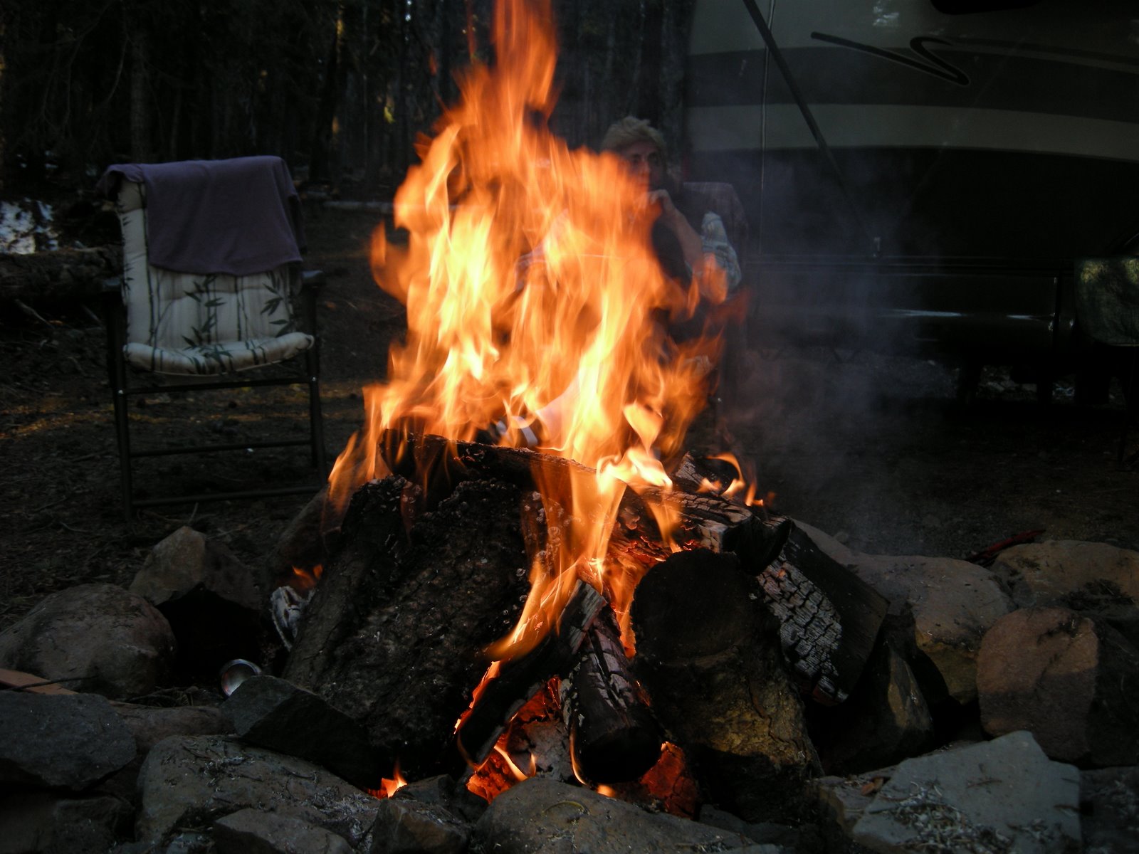
We camped with the slide closed, but still had plenty of room to cook a good supper and relax with a movie.  I have to thank Laurie Brown once more for helping us to finally understand our inverter!  We have traveled in the MoHo for two years without understanding that the tv and dvd would work if the inverter was on. 

Reservoir to home (1)The night was starlit and perfectly still, and even though we were fairly close to the road, the closed gate and complete absence of traffic made it feel perfectly safe. I watched the sun rise this morning over the basalt hills and felt incredibly grateful for this perfect last night.  Our trip home today through Alturas is on familiar roads and landscapes.  Mt Shasta will rise up in the distance to mark the passage and tell us we are close to home. 

I will call my daughter, we will stop at Fred Meyer for gas and groceries for home, we will dump the tanks at our local city park on the way out to Rocky Point. This trip of 7,714 miles will end, and it will be time to start thinking about the next one.

There are a few more photos for this last day of travel linked here>

reservoir to RP (21)

HOME, BOTH OF THEM

September 30 The Loneliest Road in America

Ely to Reservoir (3) In July of 1986, Life Magazine described Nevada’s Highway 50 from Ely to Fernley as the “Loneliest Road in America”.  Life said that there were no attractions or points of interest along the 287 mile stretch of road and recommended that drivers have “survival skills” to travel the route.

Things have changed a bit, but not much.  The biggest change is in the vehicles we drive along these roads rather than the roads themselves.  I remember desert driving and the days of vapor lock, overheated engines, flat tires, and no air conditioning.  Cars seem to be made better these days, and we cruise along at 70 miles per hour without a thought about our survival. There really is quite a lot to see in Ely, and we plan to return, especially to visit the Great Basin National Park on the eastern edge of Nevada.  We also want to come back to check out Ely’s treasure: The Nevada Northern Railway Museum,  touted by the Smithsonian as the most complete authentic railroad complex in the country.

Ely to Reservoir (6) That is what we are doing today, cruising along, covering the distance on US 50 instead of I-80, enjoying the eyeball stretching vistas of the high Nevada desert.  There are a couple of towns between Ely and Fernley where we will turn north toward the Black Rock Desert.  Eureka and Austin are both historic mining towns from the heyday of Nevada history in the late 19th century. We will stop and take photos, enjoy the stories, and the time travel provided at these outposts before moving on down the road.  At Gerlach, we will pass the sandy roads leading to the Black Rock Desert where the wild ones have their Burning Man festival every year.

Ely to Reservoir (21)Somewhere in the middle of nowhere, we saw a large group of road bikers pedaling up the long grades, supported by a couple of vans in pursuit.  At the same time, we saw a lonely man walking in the opposite direction up another grade with some sort of walk.com sign on his back.  Then nothing again but low sage and rabbitbrush and the distant hills. The air again is smoky, not in the concentrated way that it was yesterday in Utah, but high hazy widespread smoke that extends as far west and north as we can see, even from the summits.  We are traveling west again through basin and range, so the MoHo is climbing the ranges and dropping into the basins repeatedly shifting gears as we go up, then down, then up, then more down.  Glad I am not on a bike!

Ely to Reservoir (37) This morning in our full hookup park, I took the time to cook a good breakfast and clean the house a bit.  In the process of cleaning the toilet, adding extra water to help with the black water flush to come, I suddenly dropped the large cleaning washcloth right down into the holding tank.  Ugh!  I freaked out, but Mo patiently bent a hanger, fished around in there, and got the thing out of the tank before anything got terribly clogged up. Kind of amazing that we actually had one simple wire hangar in the closet among all the fancy lightweight things I have for our clothes. I got all teary and realized that the stress of dropping a washcloth into the sewage holding tank shouldn’t be THAT bad, and thought, gee, maybe I am sad about the trip coming to a close. 

Today and tomorrow we will continue our trek across the deserts and over the Warners into the Klamath Basin, to the base of the Cascade Mountains.  Home.  I am sure it will take a bit of settling in to really appreciate being there and not here, traveling along some highway with ever changing views out the windows. 

There are a some more photos for this day linked here>

September 24 Over the Rockies

Chatfield to Gunnison (9) We headed west over the Rockies today, no more agenda, no more visiting or guests, just homeward bound.  Of course, between here and home lie the red canyons of Capitol Reef, my heart home and sweet spot on the planet.  Before we slip into canyon country, however, I thought it might be fun to wander west via a different route than the fast, winding interstate across the mountains out of Denver.

We chose Highway 285 south from Littleton, across Kenosha Pass, famous for its mountain bike trails, turning west on US 50, the road that crosses the US from coast to coast.  Another climb, Monarch Pass, looked challenging on the map.  How in the world do we haul the baby car over 11.300 feet?! The best part of the day was going to be the ability to drive as long as we felt like it, and then stop wherever we wanted to stop.

Chatfield to Gunnison (31) The passes were a piece of cake, really, most of the way had two lanes and the steepest grade was maybe 6 percent.  The MoHo has an automatic transmission downshift, so that  makes the downhill sides of the passes easy and safe as well, even though we don’t have any extra brakes on the car.  The aspens are turning at the higher elevations, and the colors were backlit by the afternoon sun.

The only problem with this plan is that it all went by much too quickly.  We saw two forest service campgrounds on highway 50, just before 1pm, and thought it was way too early to stop.  Once over Monarch Pass, however, the west slope of the Rockies opens up into big wide ranching country, and by the time we found a place to stop around 3, the landscape was as barren as any we have seen in Nevada.

Chatfield to Gunnison (20) Don’t get me wrong, I love the desert.  Rabbitbrush and sage are familiar to me and camping in the wide open spaces is something we actually seek.  But on this day, somehow, I thought I would be camping in the Colorado Rockies, among spruce and aspen.  Instead I am at the Stevens Creek BLM campground on a reservoir of the Arkansas River, surrounded by sage and silence.  The skies are clear, and at 7600 feet, I am sure the stars will be breathtaking. 

Not far north is the Black Canyon of the Gunnison, a dramatic National Park, and yet the drive there looks tortuous and we have decided to continue west on 50 tomorrow morning and camp tomorrow night in Canyonlands, at the Island in the Sky, at Horse Thief BLM campground.  Canyon country calls, red canyons, not black ones, and I am a bit like a horse heading for the barn.

The rest of the photos for this day are linked here>

Day 1 Memorial Day weekend

May 22, 2009
When Mo and I planned to go camping on the Memorial Day weekend, our priorities were simple. Not too far from home, and a campfire. Of course, water is always on the list, since camping usually for us includes kayak time. Well, maybe not in the desert. When I indicated that I could get away from work for a long weekend, Mo said, “I really want to go camping, and I want a campfire.” I said, “Didn’t the desert work for you?” “Yeah, but that was last month. I need my camping fix at least once a month.”

So we cast about for places close by that would fit the bill and decided that the perfect spot would be Diamond Lake. A little jewel of a place that isn’t too far from home, and where we scoped out some campsites a few years ago, intending to return. Of course, it is Memorial Day weekend and we do have enough common sense to realize that things may be full and we may have to leave early. I am still working, and so for me, early was driving 8 hours to Klamath on Thursday and pulling out of Mo’s driveway bright and early Friday morning. Not early enough, probably, but the best we could do. There are more than 485 camping sites in the three campgrounds around Diamond Lake, many of them rv sites. What wasn’t clear at all from the website for the Umpqua NF was that only one campground would be open, and only half of that one. Snow still is in big drifts along the roads leading to Theilsen View and Broken Arrow camps, but we still really don’t have a clue why half of the Diamond Lake Campground was still closed. With the lack of personnel around and the continued closure of the Diamond Lake information kiosk operated by the Forest Service, we surmised that it probably had to do with a lack of funding and people to clean the bathrooms and empty the garbage.

We arrived around 10 am, scoped the available sites which were all filled, some even still snowed in and waiting for a camper with a shovel. We drove up to the north side of the lake to the Diamond Lake Resort store to ask about possible locations. The crusty owner said, “hell you can camp up on the hill” and when I asked how much, he said, “nothing.” So we drove out and found the dirt driveway leading up to some primitive sites that were filled with debris, and dirty snowbanks. But the sites were big, long, and level, had some great firepits, and a view of the lake. Never mind that that view is accompanied by the constant sound of big diesel rigs hauling boats out of the water. It still was better than the parking lot at Half Moon Bay, where we camped for the last Labor Day weekend when we ambled off with no reservations. I guess it seems to be our style to just wander around and see what we can find.

After we pulled in, with the sites a bit ambiguous, a fellow camper came up to tell us that the resort was requiring everyone to leave tonight because the fancy rv park down the road had opened today and the resort wasn’t allowed to compete. Hmmm. Well, maybe we will just sit tight for a bit. We set up camp, put out the nifty solar panel and let the batteries charge up nicely, put out the slide, opened the awning, the table, the chairs and a couple of glasses of wine. Perfect. Later in the day, after we drove around a bit and checked out the packed RV park and the rest of the packed campgrounds, we returned to our little spot in the woods to find some more people trying to park. Seems as though the resort owners here gave up since the rv park was full and they were letting people park in this lot.

So, once more, instead of camping in a forest service campground as planned, we are boondocking. Free camping, a water faucet that actually works, and Mo has a great huge fire going. Then, after deciding to check out the electric outlet, we found that it worked as well. Couldn’t be better. We spent a lovely evening watching a great movie on DVD. Hmm, does it still qualify as boondocking just because it is free? For the entire weekend, we watched people come and go, with the mystery of who was paying for the electricity and monitoring the site unanswered. We didn’t find out until we pulled out on Monday morning that we were parked in the official employees quarters for the Diamond Lake resort, and that it was a one-time deal. Great luck for us! We also were thankful that by this time next year I will be retired and we won’t have to wait until the holiday weekends to find a place to camp.

We took a little afternoon break and then explored the closed road to Theilsen View Campground, 4x4ing through the snow banks as far as we could before we took off walking the bike trail. The views of Mt. Theilsen were gorgeous, the water was clear, and we found a great spot for a kayak launch the next day. We spent the rest of the evening enjoying the fire. Perfect. There was even a huge pile of debris all around us for burning, so we won’t run out of firewood. The sun was shining with no rain in the forecast, the temperatures just cool enough for a sweater, and not a soul within 100 yards of our camp!

Day 8 and 9 Boondocking in the Alabama Hills

Can you see the MoHo tucked away in the boulders?

Photos here

Some time ago, Laurie (of Semi-True Tales) blogging fame, wrote about how much they loved boondocking in the Alabama Hills on the eastern slope of the Sierra Nevada. Mo and I tried to get there last fall, but were stymied by a winter storm that closed the passes. This time Mo traveled the desert for a week before I caught up with her in Kernville, and I’ll write about that a bit later, but I wanted to share some photos of the hills where we spent two dark and quiet nights, all alone, free of charge.
Funny thing, we found a BLM campground not far away on the other side of Whitney Portal Road, 10 bucks a night, and even at half price with our Golden Age pass, and couldn’t for the life of either of us figure out why someone would pay to stay there instead of tucked away among the boulders in the perfect boondocking site.
The hills were a great jumping off point for a couple of days exploring Old Highway 395, checking out the fault slip generated by the 1872 Lone Pine earthquake, driving up to Whitney Portal, and getting as high in the White Mountains and the Bristlecone Pine Forest as the roads would allow, and of course, searching for wildflowers.