Picasa photo link for today:
http://picasaweb.google.com/kyotesue/TravelingToSpokane
Wednesday morning
Finally, finally, a MoHo trip. Reading about all those folks who are full-timing out there is so much fun, but for us for the time being, we have to take what we can when we can. I left Jamestown at 3am in order to get to Mo’s early enough in the day for us to have a nice evening on the Columbia River on our way to Spokane. Our route from Klamath took us north on HWY 97, through Bend and Redmond to Madras and on north to the Biggs Junction on Interstate 84. Even though we were in Madras just a little more than a year ago, it was incredible seeing the growth and development that is occurring along that corridor. Redmond is now boasting big houses and brand new huge shopping centers that may eventually rival all the growth in Bend. The traffic was bad as well, with everyone in a hurry and aggressive. I kept wondering if really was a Tuesday afternoon and not a busy weekend. I also wonder what kind of recession we are really in, because even at more than 4 bucks a gallon there are a lot of big rigs, big trucks, rv’s, boats and toys being hauled around on the highways. Someone still has the money to play, as we do I guess. I know some people are really feeling all this, and I wonder how long it will take to hit the rest of us out here traveling the highways. So far we have managed to keep on doing whatever it is that we would be doing if gas were cheaper. We still drive 60mph to try to keep our mileage better, still buy discount gas at safeway and Costco whenever we can, but we still go where we want to go.
We are back on I-84 following Dan to Spokane after a really nice stop at theriver for a relaxing overnight. We originally planned to stay at the Maryhill State Park on the Washington side of the river at Biggs Junction, but the price was a bit steep at 38. We found the much less expensive LePage Park at the John Day Lock and Dam. Our national pass saved us half the hook up price which is a deal at $17. anyway, with electric 30 amp and water. The park itself is small and pleasant, with decent 2 bar telephone service. I let our air card go since I really didn’t want to keep paying 60 a month for that service when we aren’t traveling full time. I hope I don’t miss it too much. I suppose I can hang out at rest areas if I really need to get on the internet now and then. It all balances out eventually.
We are caravanning to Spokane from the park with Mo’s brother Dan. Being a bit independent, this is the first time that we have done this with someone and it’s a bit different, but should be fun. Dan and Chere, Mo’s brother and sister in law are in a nice Class A rig pulling a jeep. Her other brother Roger, who also has a Class A couldn’t make the trip this time, so we are the only two in the caravan. Does that qualify as a caravan?
We had a truly lovely relaxing morning today, after finally falling asleep during a very hot night. It was sunny and 104 degrees yesterday when we arrived at the park at 6pm. Hot, with a dry wind that made it feel like a real desert. We set up, and appreciated how easy this is getting for us now that we understand all the little details, but of course we still don’t have to do the satellite dish thing, and at this park we didn’t even have sewer, so it was all pretty quick. Steps worked, levelers worked, slide worked. I love it when things work. Funny side story however, this morning we ran out of water pressure as our fresh water tank emptied. Couldn’t figure out why, since we were supposed to be hooked up to shore water, and Mo finally found a little plug in the faucet that she had put there to keep bugs out while we were traveling. Oops, I didn’t take it out when I hooked up the water, and of course, we were just running off our water tank instead of shore water. Little things.
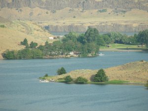
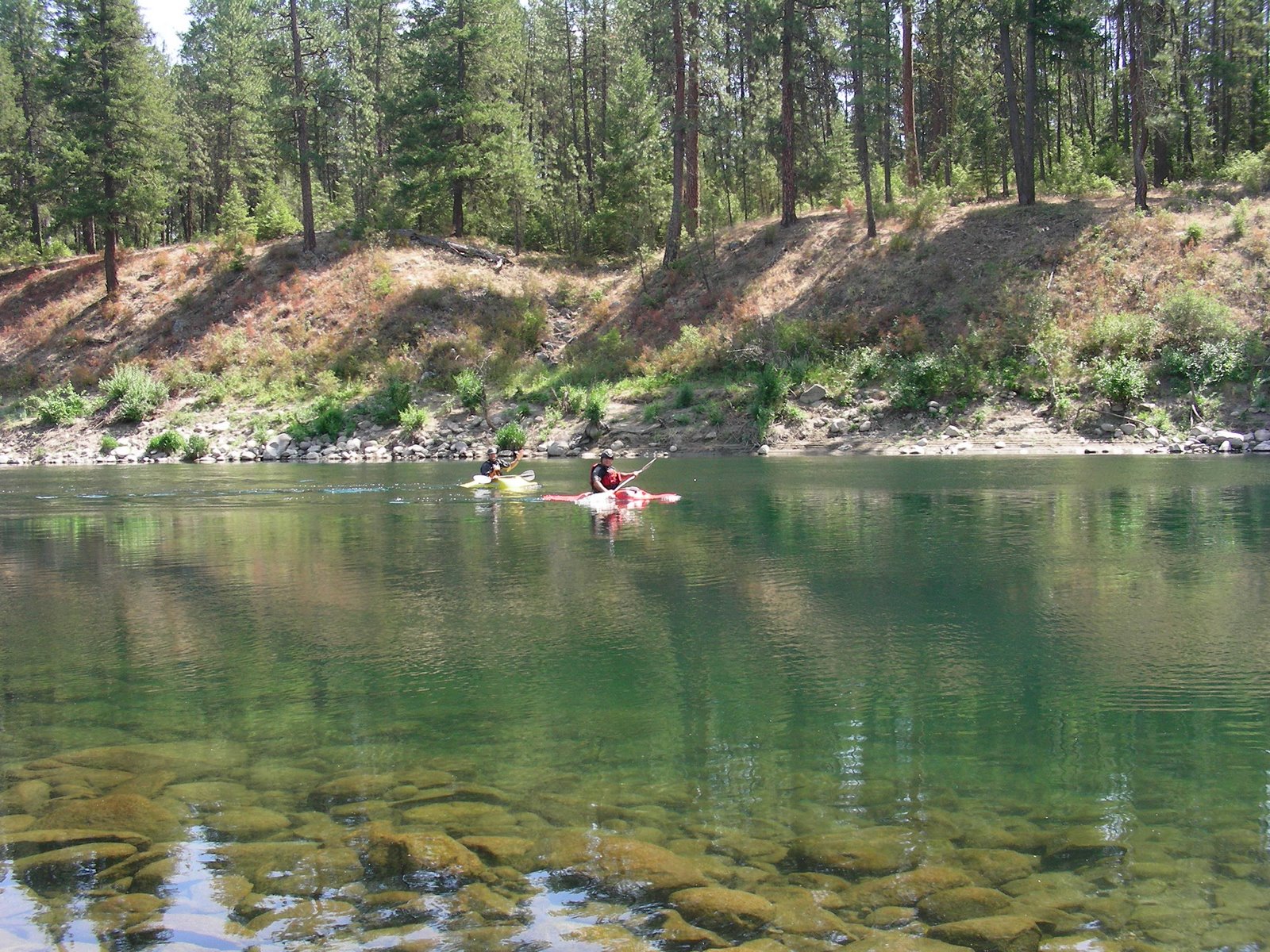
Dinner was about as good as you get, and fast as well. The little gas bbq that I got from Wal-Mart is still a hit, heats up fast and we had magnificent bbq’d pork chops in about 10 minutes, while I put some cole slaw together and microwaved a sweet potato. A glass of good red wine and things couldn’t be better. After dinner we took Abby swimming and discovered that the John Day River in this area is dammed up by the John Day dam enough that even though it’s deep, there isn’t enough current to worry about the dog getting carried away, so she had a great time swimming in the deep water, and then later when we took her over to the swimming beach where she kept trying to find water deep enough to swim in. The park itself is a really nice place, and we added it to the list of places where we might return and spend a few days hiking and definitely kayaking up the John Day River. Even though the park is in close proximity to the interstate, we couldn’t hear it at all down in the park, and even though the spaces are close together, they are all pointed toward the river in such a way that when you are sitting at your table, it’s still private enough that it isn’t too bad. We had a young couple with kids right next to us in a tent, and the only bad part was waking up at 530 am in a funny mood and worrying that our silly laughter might wake the neighbors.
We were waiting for Dan and Chere to arrive after 10 or so, so we had plenty of time to go for a nice hike up along a service road that paralleled the river along the middle slope of the basalt. High enough to see the rivers and trains and such, but not so high and steep that it was a difficult hike. We were entertained by flocks of chukkars running straight up the cliffs, lots of deer tracks and coyote tracks, and then Abby found a rattlesnake who obligingly gave us a great warning as we approached. Mo tried to get a photo, but I won’t know if it came out till I upload the photos.
Basalt on the Columbia Plateau and in this canyon is part of what is one of the largest continuous basalt plateaus in the world. I think the only large one is in India somewhere. The basalt has several different members with different characteristics, and different flows within individual members that have differential rates of cooling that makes them look like pillars and pillows, and little square chunks called entablature. http://www.cwnp.org/naturalist/basalt.html Then there are in between layers of pillow basalts that cooled under water, and conglomerates that were picked up from old river beds by the hot lava and all sorts of other interesting things. Of course, this area was also flooded 13,000 years ago by the catastrophic Missoula Floods, another fascinating story, so some of the very old rounded alluvial gravels that we found may have come from ancient Lake Missoula which covered a very large part of the state of Montana before the ice dam broke and created the floods. http://en.wikipedia.org/wiki/Missoula_Floods
Regardless of the origins, the basalts are fascinating and lovely to look at while hiking along the canyons along the rivers.

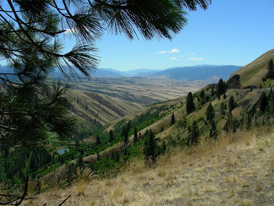 The photo is taken at the top of White Bird Hill, site of a famous battle involving the Nez Perce and Chief Joseph. http://www.nps.gov/nepe/
 with many switchbacks, now a very long down grade of 7 percent that makes me very happy with the MoHo’s tow-haul feature that downshifts with just a slight touch of the brake. I lived here when the hill opened and the first weekend a semi hit one of the runaway truck ramps, and because it was unexpectedly frozen, the trucker was launched out over the 1000 foot hill to an unhappy end. Here is a great photo from the 1920’s of the original road which had 64 turns in less than 10 miles. http://www.idptv.state.id.us/buildingbig/hiways/lewistonhill.html
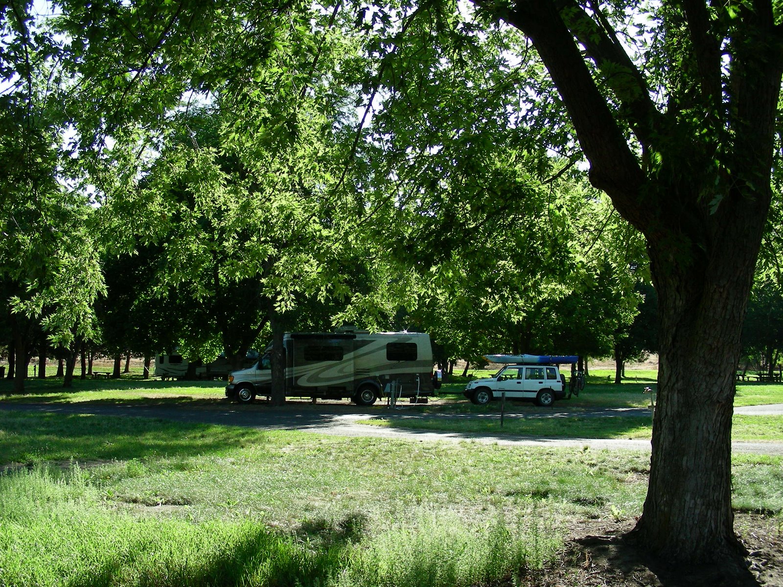 This is a place worth returning to, with so much around the area to explore, including a long lovely river walkway that goes for several miles along the Snake and the Clearwater. In a little while we will head south and plan to go through John Day in Oregon and then on to somewhere unknown for the night tonight before we head home tomorrow via Mo’s brother’s home in La Pine. We couldn’t ask for a better day to travel through this part of Idaho.
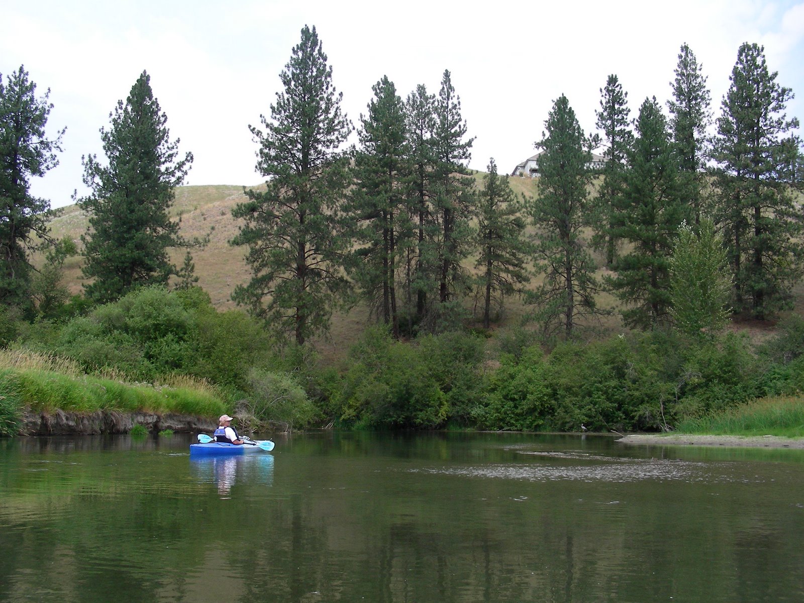


