Day 1 Sunset Bay

Our route to the Oregon Coast was delightful, traveling HWY 140 to Medford, north on I-5 to Roseburg (not so leisurely with all the hills and curves), then west on HWY 42 from Roseburg through Coquille and on to Coos Bay.

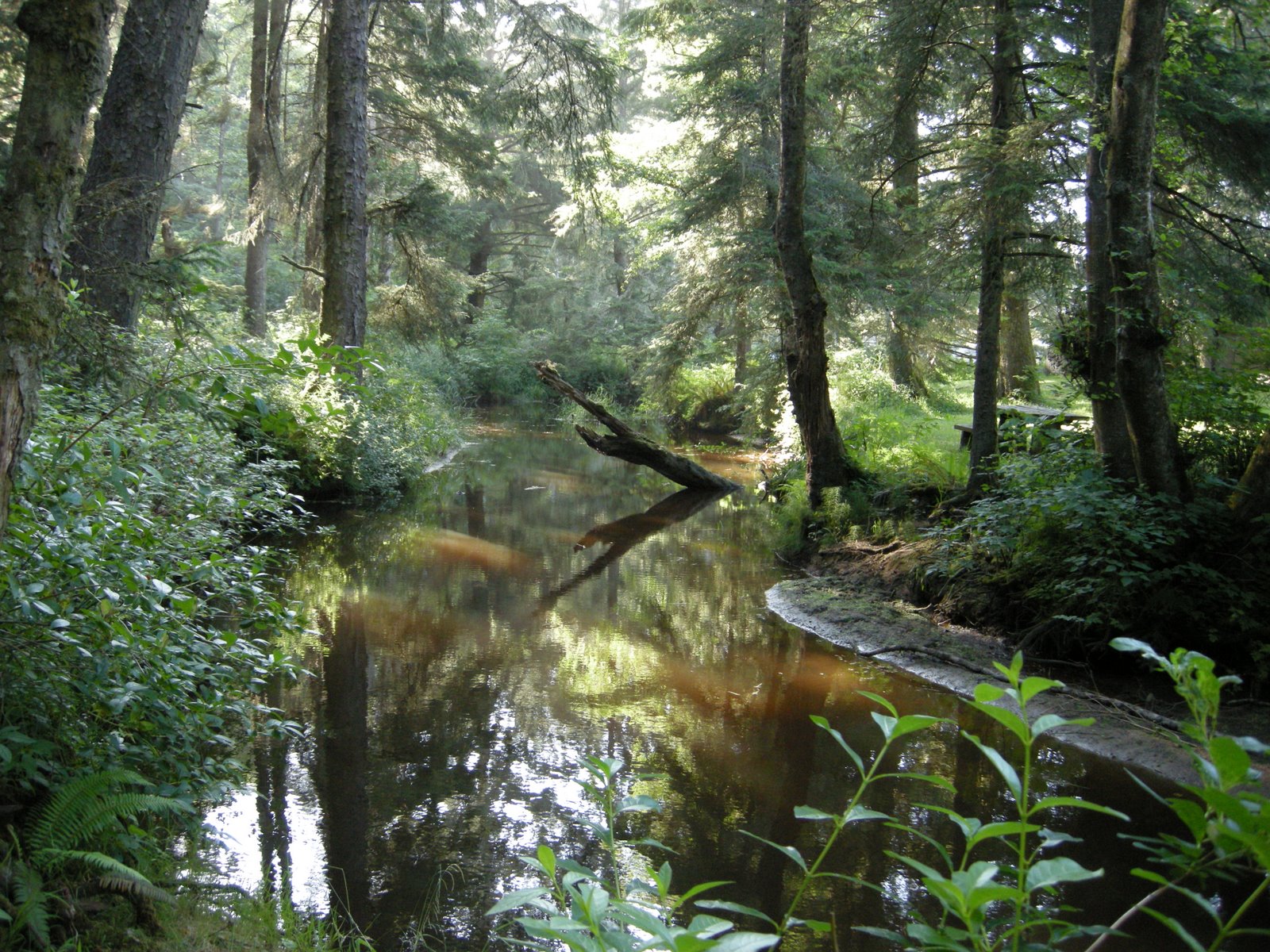
The destination this time was Sunset Bay State Park, southwest of Coos Bay on the Cape Arago side road, off the busy track of 101. This particular route over the coast range wasn’t nearly as difficult as some can be. It seems there aren’t many ways to get from the Willamette Valley to the Oregon Coast that don’t involve lots of curves and hills, but even in the motorhome, this one wasn’t bad. We saw lots of rv’s returning from the west and were glad we were going the other way on this Sunday night.

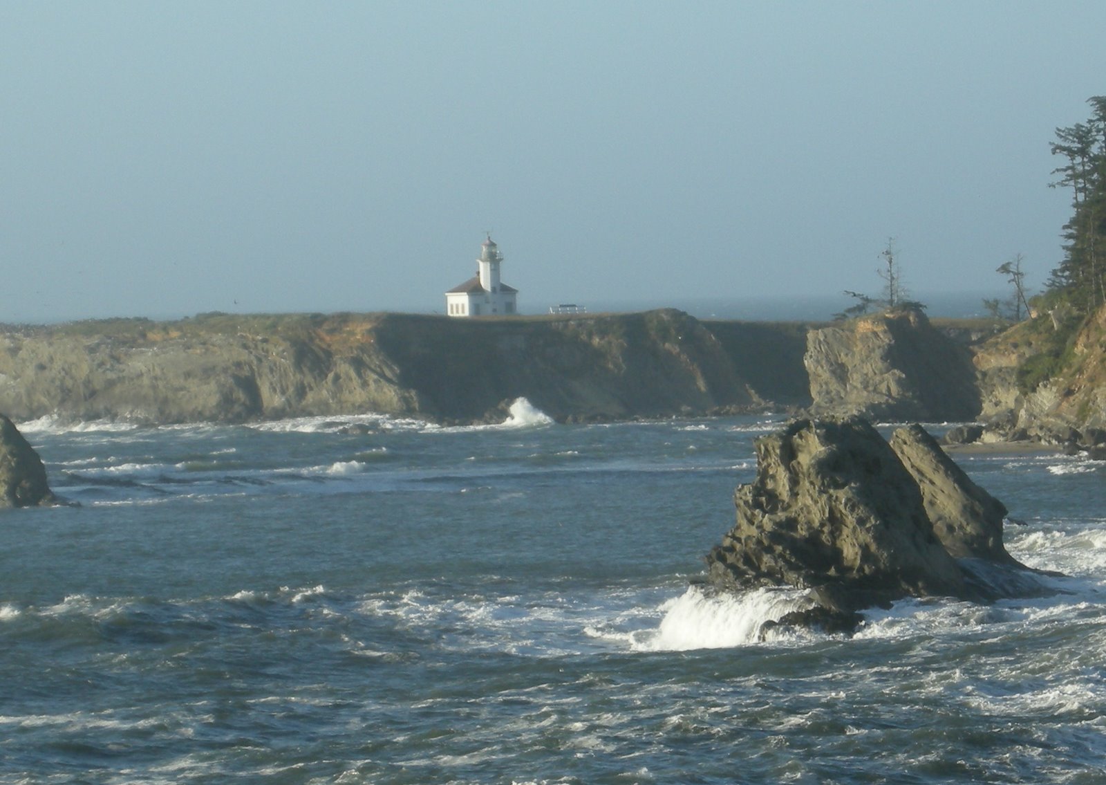
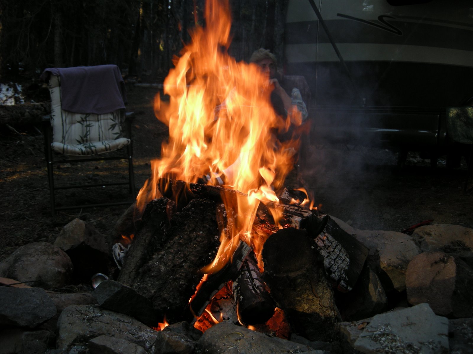
At the moment, I am listening to the crackling campfire and the repetitive moan of the Cape Arago Lighthouse fog horn in the distance, muted by the sounds of crashing surf and winds in the higher treetops, and children on bicycles. Great sounds for a late Sunday afternoon settling in.

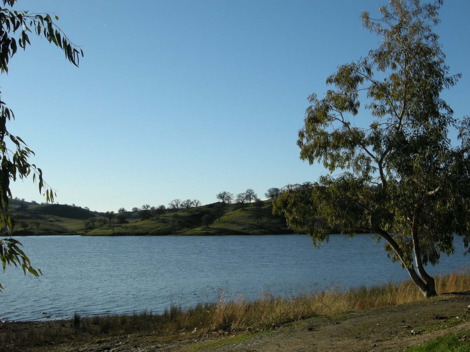
This lovely quiet stream is Big Creek, winding through the park to the bay. The trails here are wonderful, wandering through deep dark forests, climbing to high bluffs overlooking the ocean, and back down to empty beaches. Sunset Bay is a protected little cove, surrounded by Douglas-fir and spruce forest, and a gentle surf.

Even with the possibility of inclement weather, Oregon Coast camping is a fairly refined version, especially with rv hookups, cozy canvas yurts, even special sites for bikers and hikers doing the Oregon Coast trail, which passes through the park as part of it’s 297 mile journey along wild 
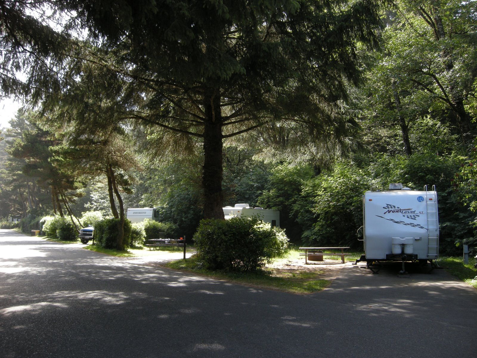
stretches of beach, cliffs, and headlands. Even the parts of the trail that wind through towns on HWY 101 have lots of signs reminding drivers to share the road, and nice wide bike lanes.

At the moment, though, I am very happy to be in a motorhome, and not trying to pedal a bike and pack up some of those long steep hills to find the next campsite.

The park here is clean and lovely, quiet, refined, fresh, and blessedly cool, with temperatures all week forecasted in the high 60’s and sunny skies. Breezy, I think it said. An understatement, of course. Breezy on the Oregon Coast would be considered windy just about anywhere else, but cool and breezy is much better than rainy and windy, so I am not complaining in the least.

Mo made the reservation for this site just a couple of weeks before the trip, and the park was full most of the time we were there. I think arriving on a Tuesday any other week would have been ok, but reservations are still a good thing. Back-in sites on the outside perimeter are nicest if you can back in, more privacy. The site we were in actually had a sewer hookup, but the park asks that you don’t empty your full tanks here, and instead go up to the adjacent county park and dump there for a fee. We never tried our tv, although some people had their antennas up. Cell service wasn’t available in the park, but was fine back in Coos Bay. Nice for a complete vacation, no phone, no computer, no tv, and I never missed any of it.

Day 1 Memorial Day weekend

May 22, 2009
When Mo and I planned to go camping on the Memorial Day weekend, our priorities were simple. Not too far from home, and a campfire. Of course, water is always on the list, since camping usually for us includes kayak time. Well, maybe not in the desert. When I indicated that I could get away from work for a long weekend, Mo said, “I really want to go camping, and I want a campfire.” I said, “Didn’t the desert work for you?” “Yeah, but that was last month. I need my camping fix at least once a month.”

So we cast about for places close by that would fit the bill and decided that the perfect spot would be Diamond Lake. A little jewel of a place that isn’t too far from home, and where we scoped out some campsites a few years ago, intending to return. Of course, it is Memorial Day weekend and we do have enough common sense to realize that things may be full and we may have to leave early. I am still working, and so for me, early was driving 8 hours to Klamath on Thursday and pulling out of Mo’s driveway bright and early Friday morning. Not early enough, probably, but the best we could do. There are more than 485 camping sites in the three campgrounds around Diamond Lake, many of them rv sites. What wasn’t clear at all from the website for the Umpqua NF was that only one campground would be open, and only half of that one. Snow still is in big drifts along the roads leading to Theilsen View and Broken Arrow camps, but we still really don’t have a clue why half of the Diamond Lake Campground was still closed. With the lack of personnel around and the continued closure of the Diamond Lake information kiosk operated by the Forest Service, we surmised that it probably had to do with a lack of funding and people to clean the bathrooms and empty the garbage.

We arrived around 10 am, scoped the available sites which were all filled, some even still snowed in and waiting for a camper with a shovel. We drove up to the north side of the lake to the Diamond Lake Resort store to ask about possible locations. The crusty owner said, “hell you can camp up on the hill” and when I asked how much, he said, “nothing.” So we drove out and found the dirt driveway leading up to some primitive sites that were filled with debris, and dirty snowbanks. But the sites were big, long, and level, had some great firepits, and a view of the lake. Never mind that that view is accompanied by the constant sound of big diesel rigs hauling boats out of the water. It still was better than the parking lot at Half Moon Bay, where we camped for the last Labor Day weekend when we ambled off with no reservations. I guess it seems to be our style to just wander around and see what we can find.

After we pulled in, with the sites a bit ambiguous, a fellow camper came up to tell us that the resort was requiring everyone to leave tonight because the fancy rv park down the road had opened today and the resort wasn’t allowed to compete. Hmmm. Well, maybe we will just sit tight for a bit. We set up camp, put out the nifty solar panel and let the batteries charge up nicely, put out the slide, opened the awning, the table, the chairs and a couple of glasses of wine. Perfect. Later in the day, after we drove around a bit and checked out the packed RV park and the rest of the packed campgrounds, we returned to our little spot in the woods to find some more people trying to park. Seems as though the resort owners here gave up since the rv park was full and they were letting people park in this lot.

So, once more, instead of camping in a forest service campground as planned, we are boondocking. Free camping, a water faucet that actually works, and Mo has a great huge fire going. Then, after deciding to check out the electric outlet, we found that it worked as well. Couldn’t be better. We spent a lovely evening watching a great movie on DVD. Hmm, does it still qualify as boondocking just because it is free? For the entire weekend, we watched people come and go, with the mystery of who was paying for the electricity and monitoring the site unanswered. We didn’t find out until we pulled out on Monday morning that we were parked in the official employees quarters for the Diamond Lake resort, and that it was a one-time deal. Great luck for us! We also were thankful that by this time next year I will be retired and we won’t have to wait until the holiday weekends to find a place to camp.

We took a little afternoon break and then explored the closed road to Theilsen View Campground, 4x4ing through the snow banks as far as we could before we took off walking the bike trail. The views of Mt. Theilsen were gorgeous, the water was clear, and we found a great spot for a kayak launch the next day. We spent the rest of the evening enjoying the fire. Perfect. There was even a huge pile of debris all around us for burning, so we won’t run out of firewood. The sun was shining with no rain in the forecast, the temperatures just cool enough for a sweater, and not a soul within 100 yards of our camp!

Day 7 Kernville and Tilly Creek

Our photos of Kernville are here Visiting Kernville
March 27 Friday

Even though I lived in Kernville back in the late 60’s, I barely recognized anything there. I tried to find the house along the river where I brought my newborn daughter in 1969, and while a house was there, it had been remodeled. I could only tell where I was by turning around and looking across the little park road to the river, where I recognized the view. The house I lived in before that in Lake Isabella nearby was also gone, covered over by a new 4 lane highway, south of the dam. It was still great being there, and remembering how life was when I had four little children under 6 and Melody was an infant in my arms. Time has a way of going by I guess, and I know that is a very trite, often repeated statement, but when you visit old haunts, words fail the feelings. It was good to go there and good to leave.

We camped in a lovely campground almost right in the town of Wofford Heights, Tilly Creek, on southwest side of Lake Isabella. The campground was nearly empty, but the caretaker told us that on the weekend to come, it was booked completely. It seems that there is a fishing derby, and 3 fish in the lake have been tagged with a 10,000 ticket. Catch that fish using specific gear from a specific sporting goods store and they double the prize. It was a bit daunting to imagine that lake covered with boats, all crazy for winning that 10K prize. We were really glad our timing was so good, even by accident. Note: don’t plan to camp anywhere near Lake Isabella on the first of April!

March 28, Saturday.

We left early in the morning, traveling east on 178 and north on the great road 395. I know that the Mother Road HWY 66 has its lore, but HWY 395 is truly a magical road leading from southern California cities, through the deserts, along the backside of the Sierras, through the edge of basin and range landscapes, through ancient calderas, new lava flows, huge lakes with no outlets, and wild country. I think there are more rock hounding sites on 395 than just about any road I know. Much of it is just 2 lane, and in some parts of Oregon, you won’t see another car for hours. Great road, but not so much in the winter. I have been in snowstorms on 395 going into Reno in May. You definitely need to plan and watch the weather if traveling that route.

A January reprieve

Lake McSwain

Sometimes I am more aware of the delights of living in California than others. January is one of those times, when most of the country in mired in cold and snow, the northwest is inundated with rain, and camping isn’t the first thought on your mind. Instead of nestling in to a warm fire and gray skies for the 3 day weekend, as I might have done in Oregon, Mo and and I headed out for a little bit of peace and quiet in the California foothills.

My only requirement this time was that I really really didn’t want to cross the central valley once more. We searched around for local camping spots, and after narrowing down the possibilities, came up with Lake McSwain. It turned out to be a lucky guess. The adjacent reservoir and camping area at Lake McClure wasn’t nearly as inviting as our little family campground by the narrow lake between the Exchequer Reservoir and Merced Falls. Lake McSwain is just a reservoir as well, but being long and narrow, in spite of the drought, the water levels weren’t as low as the bigger reservoirs and we enjoyed the lake view from our camp site.

Lake McSwain is a little hidden secret and has the reputation of being known as the very best fishing lake in California. This may be due to the elaborate trout, king salmon and Florida largemouth bass stocking programs. Or perhaps it is because so many fish call the lake home, including rainbow trout, black bass, spotted bass, bluegill, crappie, catfish, salmon and shad.

The campground itself was delightful, with lots of choices and plenty of space between sites, and wonder of all wonders, not one single night light to be found. The skies were dark and full of stars until the quarter moon rose long after midnight. We chose not to bring wood, since it is buried in snow at Mo’s house in Rocky Point, and that was a good thing as well, since campfires weren’t permitted anyway. The park lent itself well to short but delightful walks around the lake, long sessions of reading novels and knitting, and our favorite big breakfasts, even without the fire.

There is a road that continues past the campground to the bigger reservoir, and we took a long walk east along the road on one morning, walking down the hills to the waterside for Abby to enjoy her swim. The landscape is rough and steep, but the campground itself is gentle and welcoming, and not too crowded. Most of the people there seemed to be families who were fishing, and we saw lots of stringers of big trout on lines. There were lots of dogs as well, and the extra 3 bucks that is charged for a dog must be bringing in a good amount of change for the park.

We watched the sun rise and set for a couple of days, and thoroughly appreciated the silence of the place. Quite a surprise. There was also an area with sewer hookups, but it looked much too much like a typical RV park with sites lined up in rows, close together. We were grateful for our open spaces, walked around and wrote down our favorites, and made lists and mental notes of future winter camping days that very likely may be in this happy little place.

This little campground was only 45 miles from home, and on the way back we took a few side routes and discovered another little gem along the Tuolumne River. The campground borders the Tuolumne River with great kayaking access, and huge Valley Oaks. Turlock SRA

Next time we will bring the kayaks, which we missed having along on this trip, but they were left behind in Oregon. I will be glad when everything is in one place, the bikes, the kayaks, the motorhome, the baby car, all together so that if we go somewhere spontaneously we can still have all our toys with us. For now, though, a simple little weekend trip was just the ticket.

Picasa photos for this post

Sequoia National Park

http://picasaweb.google.com/kyotesue/Sequoia#

We woke up in Kings Canyon to a very cold morning, but the sunny skies were encouraging after all the predicted rain and snow for the Sierra’s this weekend. We arrived at the boundary of Sequoia National Park in the early afternoon after driving some seriously rough roads throughout the national forest, the national monument, and the national park. Sequoia doesn’t lend itself well to much in the way of sightseeing aside from the major grove that is home to the General Sherman Tree and what is called Giant Grove.


There were several roads that were limited to us because of our length over 22 feet, but we still had time to walk the major groves, see the really big trees, and find a place to camp at the open campground called Lodgepole. It was still cold enough that we needed hats and gloves for hiking, and the warmth of our furnace was really welcome after we got set up for evening.

The campground at Lodgepole is extensive, more so than we realized at first, and there are loops that are by the river, and other loops that say “no generators”, and many delightful places to camp among the granite boulders. Lodgepole has a market and a visitor center that is open year round, although I wouldn’t particularly like driving those rough curvy roads in winter, even if they are plowed!

The store provided a nice bottle of wine and the heater made for a lovely afternoon nap in the sunlight streaming in through the window, and we didn’t need much else to be perfectly content.


The little coyote (photos at the Picassa link) was our camp mascot, trotting into the camp as we set up, and lying down to see if we were going to leave anything around for him. We saw him several times during our stay, always alone. He really liked Abby, so we kept a close lead on her while he let out playful little growls in his throat, and finally couldn’t help himself and he howled. In spite of his early visit, we never heard coyotes in the night, but Mo was careful to keep Abby on the leash when she went out. After a great bbq supper we went for a little hike in the twilight and found the trail for tomorrow, came back to camp and started the generator and watched a movie. Especially nice because there wasn’t anyone in the campground close enough to be bothered by it. Relaxing!

The next morning dawned bright and clear and just a bit warmer after only 28 degrees for the low and we decided that the hike was doable, gloves and hats of course. The hike was lovely, about 3.5 miles round trip and never steep enough to be a problem in spite of the 7200 foot elevation. The rock cascade was dry, with just a trickle of water that was mostly frozen, but it was still nice being there, and you could imagine just how magnificent those falls would be in the spring. Returning to camp we were entertained by a couple of trout playing in the shallows of the crystal clear river under the bridge.

We packed up the rig by noon and headed down the long slide of HWY 180 to the flat valley below, filled with smoke and smog and traffic. I would love to figure out a way to enjoy California without having to cross that valley! As mentioned in the Kings Canyon post, we were really glad that we did this trip this way, since we might not make it this far into this part of California again.