With Covid19 creating all sorts of problems for travelers this year, it has been wonderful to have a way to get out a bit in our own socially distanced space. The MoHo is the perfect solution to getting away, and the only even remotely unsafe activity is buying fuel in any state that makes us pump our own.
On October 1 we loaded up the MoHo and headed north to Washington State to visit my daughter Deanna and her husband in addition to my grandkids and great grandkids. I realize that was 3 weeks ago, and I have yet to write the stories. That will come later. I somehow never managed to finish processing the photos before Mo said, “Hey, maybe we can go to Medicine Lake”.

As much as we love Medicine Lake, nestled in an ancient volcanic caldera in the highlands of far northern California, we haven’t been there in six years. Six. Looking back at the blog and the photos I was amazed that it took us so long to return to one of our favorite camping spots in the west. As I reviewed the years and went back over our calendar, I saw many factors that seemed to get in the way of our plans, not the least of which was the many years of fires creating smoky skies and closed forests in California and Oregon. This year wasn’t much different until mid-October, when the rains dampened the mountains a bit and the Forest Service re-opened the campgrounds in the California forests that had been closed for weeks.
We took our chances without reservations. After all, it is October, and at 7,200 feet nights are freezing and visitors might be few and far between. Most of the sites at Medicine Lake, in the 3 campgrounds, are on a first come first serve basis, including our favorite, number 43, in the A.H. Hogue Campground.
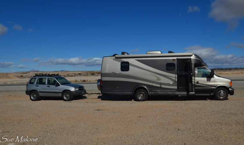
We packed up food and warm clothing, loaded the kayaks, hooked up the car, and were on the road south by 10AM. Fuel is still reasonable in Grants Pass, but we knew that boondocking for several nights would require a full gas tank. We knew there was a Pilot on our route south near Mt Shasta and Weed,and that would be the last opportunity to top of the tank before we settled into to camp for a few days without hookups. In fact, not only are there no hookups, we knew from experience that there is no cell service, no internet, no water, no trash pickup, no power, and we were ready for a few days off the grid. Nice to take a break from all the “stuff” out there going on right now.

We headed south on I-5. Funny, the map to Medicine Lake on Google shows an almost identical time and distance whether we travel south on the interstate into California, or back over the mountain to Klamath Falls. We decided to make it a loop, going south on the way down and returning via Klamath Falls.
Highway 89 was pleasant and smooth, without too much traffic, but once we turned back north on Forest Road 44 and then to Forest Road 49 toward Medicine Lake it changed. There was no traffic, I think we saw only one vehicle in the entire distance, and that was a pickup pulling a boat and trailer that was stuck in a ditch. Three guys gave us a thumbs up and we drove on. No cell service anyway so there wasn’t much we could do to help. The road was very narrow and very rough! I reminded myself to open the dish cupboards slowly. After bumpy roads all sorts of things can fall on your head if you open them too quickly.
It was 2:30 or so when we arrived at the campground and to our surprise, it was completely empty. There are 56 sites in Hogue, a few less in the adjacent Hemlock Campground which was also empty, and a few more in the Medicine Campground where there was one big rig tucked in under the trees far to the west of our campground. We unhooked up on the main road and drove right to our favorite spot.
 Site 43 is on the lake side of the road, and once in place the rig could be leveled without too much difficulty. There is a beautiful stone firepit, a nice picnic table, a short easy trail to the water and a 180 degree view of the lake. We spent some time reviewing favorite campsites we have enjoyed throughout the years, and this is by far top on the list.
It didn’t take long for us to settle in. We put out our chairs and listened to the silence. Took Mattie for a walk around the campground road and decided that we would wait until the next day to unload the kayaks since the breeze had kicked up as it often does in the late afternoon. Supper was simple, reheating last night’s pizza in a skillet and still had to start up the generator for a few minutes to get it nice and hot in the microwave. After supper we returned to our chairs to enjoy the sunset.
 Our sunset was spectacularly unspectacular. With no clouds, fires, or pollution to create color, the sun dropped behind the mountains to our west with an unceremonious ‘plop’. It was to be the case for each of the three nights we waited for sunset as we camped at Medicine Lake. Still, the afterglow on the lake was lovely as the skies darkened.
 The first night was the coldest, and when we woke the next morning it was 32 degrees. The day was clear and gorgeous once again and we decided to spend some time exploring the local roads a bit before unloading and launching the kayaks for an afternoon paddle. Lava Beds National Monument is just 16 miles north of Medicine Lake on a decent dirt and gravel road that descends from the volcanic highlands to the lava wilderness below.
Information from the website:
“Medicine Lake Highlands is the largest identified volcano (in total area) within California, and is one of the most unique geologic features in North America. Because this subrange of the Cascades is somewhat remote, the fascinating nature of this area is largely unappreciated. The great Medicine Lake shield volcano’s broad, gently sloping profile (stretching some 15 miles from east to west and nearly 25 miles north and south) belies the fact that it is actually larger in mass than nearby Mt. Shasta. The Medicine Lake Highlands Volcanic Area exceeds 200 square miles and takes in portions of three National Forests; the Modoc, Klamath and Shasta-Trinity in Modoc and Siskiyou Counties. On the Shasta- Trinity the area lies within the boundaries of the McCloud Ranger District. It rises east of Mt. Shasta near the south end of the string of Cascade volcanoes that stretch northward from Mt. Lassen into British Columbia. Approximately 100,000 years ago the great volcano underwent a series of eruptions which undermined the center of the mountain and the crest subsided to create a huge crater or caldera. Around the margins of this subsidence, new, smaller volcanoes arose; they are called rampart volcanoes. Medicine Lake now partially fills the crater. Geologists speculate over what events took place that caused the unusual shapes and features to form and how a series of eruptions changed the face of the countryside in the area. One thing is clear, however; more than a million years of volcanic activity have produced a landscape that is perhaps California’s most diverse volcanic field. Furthermore, volcanic eruptions that produced geological features within the Medicine Lake Highlands were no less dramatic than the volcanic eruptions which took place on Mt. St. Helens.”
We had camped in Lava Beds last March and wondered how the campground and surrounding area had fared after the devastating Lava Beds fires that started on July 22. Seventy Percent of Lava Beds National Monument was burned but we had heard that the visitor center and most of the campground was saved.
Traveling north as we descended to the wild lava covered landscape we discovered the Mammoth Crater site. As with most of our travels on this trip, there wasn’t a soul around and we let Mattie walk ahead of us on the trail to the viewpoint. When I declined to continue on the steep part of the trail, I received a very reproachful look. Mattie won, and I am glad she did because the view from lower point was spectacular.
 We read that Mammoth Crater and Modoc Crater are responsible for about 70% of the lava flow in Lava Beds. The lava that flowed from both of these craters is also responsible for the majority of lava tube caves found in the park. Mammoth crater once contained a massive lake of lava that overflowed instead of erupted, leaving behind the empty crater. The lava from this crater was highly fluid and traveled all the way to the northern part of the park, creating lava tube caves all along the way.

So heartbreaking to see this grand old juniper gone and the CCC table destroyed
 This what this campsite looked like in March
 This what it looked like this week after the fire
Continuing north towards the main park road, we turned toward the campground, excited to see that it was open and that people were camped. Surprisingly, there were far more people at Lava Beds than up the hill at the beautiful lake!. Driving through the campground to our previous camp site we were devastated to see that the fire had destroyed another of our favorite campsites. Last spring I took many photos of the ancient juniper that shaded the magnificent picnic table made of juniper planks attached to huge lava rocks. We loved the view when we camped last March, but today the view was much more open, but much more devastating. The park will recover. Juniper and grass and sage adapt to fire, but there won’t be junipers like this one for another couple hundred years.
 As we returned south and up the mountain toward Medicine Lake, we again remarked on the striking and dramatic view of what the fire crews managed to save. On one side of the road was evidence of serious heavy equipment clearing out the highly flammable underbrush and how the combination of clearing and the firebreak of the road managed to stop the fire. It was impressive!
 The winds were light when we returned to camp in the early afternoon and after lunch, around two, we decided to unload the kayaks and go for a little spin on the lake. The light winds were tolerable, but one of the things we love most about this lake is the beautifully still, glassy conditions that can make it such a delight to paddle. By the time we returned to camp after an hour of battling the “light” winds, our arms and shoulders were tired and our bodies were ready for some rest.
Relaxing again with our boring sunset, we made a plan for the following day. Who knows why we need a plan, but somehow setting a general time for what we want to do feels better when we are in a place where there are no deadlines, nothing we have to do and nowhere we have to be. It is an old joke for us, and goes all the way back to our very first camp together at Medicine Lake in 2003. We sat at the picnic table and Mo said, “Well, what do want to do?”. “hmm…well, we can eat and then we can do something, then we can eat lunch and do something, and then we can eat dinner.” Ever since, “we can eat and then do something and then eat” has been our inside joke.

The morning dawned as still and gorgeous as it had the previous day and even with a temperature of 38 degrees, we decided that waiting till ten to get on the lake would be a mistake. It was a perfect choice, and while our feet were a bit cold, the early morning sun warmed our backs wonderfully. We paddled across the lake just in time to see a fat and very fluffy coyote racing across the meadow, spooked out by a woman who was walking with her two dogs and didn’t know that coyote was right in front of her. We also saw herons and merganser ducks, an osprey, a young eagle, several deer, lots of sandpipers, a lovely family of grebes, and a couple of kingfishers. Our campsite was a virtual aviary of pine siskins, stellar jays, and black headed juncos. Of course, with only the phone, I have very few wildlife photos and none that are worth showing. I do miss having a great camera with a great telephoto lens. Every time I try to zoom in with the phone I get a blown-out murky photo that is not the least bit satisfying.
 By the time we got off the water two hours later, the winds were rising. We were so glad we hadn’t waited in spite of the chill. Lunch of grapes and cheese and crackers was perfect and we settled in for a bit of chair and book time before heading out for our next planned activity. Mattie loved the sunshine and relaxing part of the day and took full advantage of the freedom to be off leash with not another soul around.
The short hike to Little Glass Mountain is just north of the campground and is about .4 a mile long one way. It is in a field of pumice, shaded by old lodgepole pine. I am not a fan of lodgepole, but here they are thick and healthy and quite lovely. The little cones are just about perfect.


Little Glass Mountain has been identified as the area of most recent volcanic activity about 300 years ago. These eruptions first spread white pumice for miles around. A nearby cinder cone, Pumice Stone Mountain, was completely covered with pumice and a startling, smooth, white dome remains. These pumice eruptions were followed by flows of black volcanic glass, called obsidian. There are other obsidian flows in the Highlands area, some of which are over 1,000 acres in size. Prehistoric people used this material to make arrowheads and spearpoints. Many archaeological sites have been identified, and some artifacts indicate that the Highlands have been inhabited for at least 4,500 years.
 The temperature was perfect, Mattie could again be off leash with no one around, and the level path to the glass flow was delightful. We reached the obsidian, wandered a bit farther toward the west end of the flow and then returned the way we had come. Once in the past we thought to take off cross country and discovered that the flat landscape and lodgepole forest can be misleading. This time we stuck to the trail.
Our last planned activity for the day was to take off again in the Tracker and explore a road east of the campground that was marked, “Private Cabins”. It was a short trip, and a short road, but it led to a surprising number of forest service type cabins and homes that were nestled and tucked away in the thick dark lodgepole forest on the southeast side of the lake. From the campground, there is no clue as to the number of homes that are hiding there in the trees. We hadn’t seen them when kayaking on that side of the lake. It wasn’t particularly inviting to me. I have lived long enough in a dark forest that I appreciate open skies and sunshine and was grateful that the campground is on the south facing side of the lake.
 Our remaining activity of the day was a small one. Haul the kayaks back up the short slope to the waiting car. We both discovered that the leg strength required for getting out of the kayaks can be a bit challenging. Sure hope we can continue to do that for a few more years. Surprisingly, once we got the boats up the hill, getting them on top the car wasn’t difficult. Still managing that without much trouble. Good news.
 Saturday morning we woke easily after a night that was a bit warmer than the previous two nights, with a temp of 47 degrees at 7 AM. There were a few more people around, with two more sites occupied in our campground and a couple more east of us in the Hemlock campground. We were both really delighted with our Medicine Lake trip this year, and know that we won’t be worried about trying to camp there in the early fall months until the snow flies.
The return trip to Grants Pass through Klamath Falls held a little bit of extra fun. We had arranged to meet Katie, a good friend of ours, currently a soil scientist at the Klamath Falls office where I worked after retirement until 2017. Katie is an amazing young woman, full of life and full of adventure. It was wonderful spending a leisurely patio lunch with her as we caught up on life’s random craziness. Sorry Katie, I forgot to take photos so I stole this one from your Facebook page. You and your sweetie!
 On the trip home I remembered what I love most about the Klamath Basin. The thousands, maybe millions of birds are staging for migration. Klamath Lake was thick with coots, ducks of all kinds, grebes, pelicans, and egrets lining the shoreline. The aspens were turning on Highway 140 as we approached our old home in Rocky Point. It was a perfectly beautiful trip without a speck of drama and a lot of quiet time for us.


 Photo from our 2011 visit to the same store Deborah visited on this trip, with blue skies


 Mattie ran and played and climbed rocks, her favorite thing to do other than running wildly in soft sand.


 I can’t really claim the snowbird moniker, but somehow it seems that every year we manage to make our way south. I think to be a snowbird, you might have to stay for the full winter season and only meander back north when the light and warmth return. Still, it is an incredible delight to slip away from all that cold stuff, the snow plowing, the crashing ice dams, the skating rink parking lot, and land gently back in the desert, with simply a light shirt on in the evening, and feet once again in sandals. Ahhh.
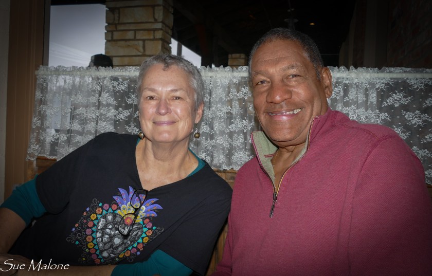 Mo and I met Laurie and Odel many years ago, when I was a brand new blogger and Laurie was one of the more well known bloggers in the newly minted rv bloggerland. Later, long after Laurie stopped blogging and they sold their beloved rig Scoopy, we stopped in for a visit to their digs and they took Mo and I to Nevada City and introduced us to their good friends Nickie and Jimmy. I love how these things work. As I am writing this, I am remembering just how we all met, and I had almost completely forgotten the details.
 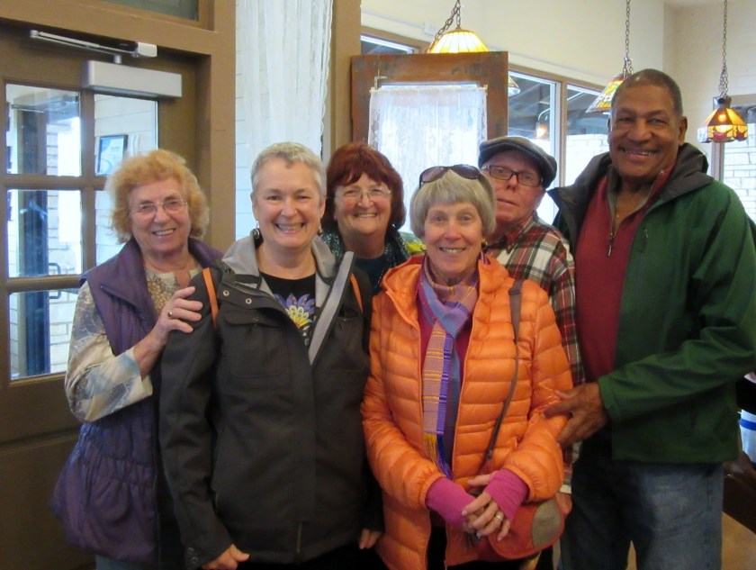 Sometimes these kinds of friendships come and go, but in this case, they are the kind that will last a lifetime. When we get together, in fours or in sixes, it is always so much fun. This time was no different. Nickie and Jimmy invited Mo and I to dinner at their place in Nevada City. The food was fabulous, what Nickie called “comfort food”, but oh my such deliciousness!
 Even better than the food, however, was the laughter. Nickie has this wondrous inner child that comes out to play a lot, and makes me laugh till my sides hurt. Mattie thought she was a kick as well, and the two of them slid around on the gorgeous hardwood floors until tiny Mattie knocked Nickie down, or at least that is what Nickie claimed. So sorry, Nickie!! I hope your bruises have healed.
 The “Big Plan” was for the six of us to meet the next day in Auburn for some yummy food, and then hike it all off with a great walk along the river and the waterfalls. The only waterfalls were coming out of the skies, with big dark rain keeping us all inside. Instead of hiking, the six of us sat together at a big round table at Awful Annie’s and ate and talked and ate some more. It was great fun being together again. We have hiked with Laurie and Odel, and with Jimmy and Nickie, but so far haven’t managed a hike with all of us. That is on the agenda for sure. What a fun bunch of people to know. I feel so lucky.
  Mattie made friends all around, but especially with Odel. Did she ever love that guy! I wish I had taken a photo of her looking at him with adoring eyes as he scratched her ears. Mattie knows a good man when she sees one!
 Beale Air Force Base is just east of the I-5 corridor and Marysville, and only 34 miles west of Nevada City, the sweet little mountain town where Nickie and Jimmy live. We decided to give the FamCamp a try and it isn’t a bad stop. The campground is fairly isolated on the base, with long open views toward the east. I was surprised at how full they were, and we were glad to have made a reservation. $18.00 per night with full hookups isn’t bad, although the sites were muddy from all the recent El Nino rains. Still, the gravel pad was level enough we didn’t have to put down the levelers, the power was adequate, and there was WiFi available, but I didn’t try it. My Verizon worked fine on the iPad, and I had no time or need to set up the computers or the MiFi.
 On the way to the campground, we saw an amazing airplane flying low and slow, circling above us. I love that about staying at an air force base, lots of cool airplanes. Found out later this was a U-2 plane, and that the woman pilot who flies them at Beale AFB is quite famous.
 Once the battery was replaced and we were traveling down the 5, everything seemed to settle into place. I think it takes a few hundred miles before it reallly feels like we are on the road, and that great feeling hit yesterday somewhere along the hills on the western side of the San Jouquin Valley. Evidence of the drought has lessened a bit, with recent rains turning everything green. Big signs are dotted among the fruit and nut orchards: “If water is used to grow food, is it really wasted?” I found myself wondering about this a lot. California is having huge water issues, with too many people wanting too little water. If that water is used to let people in the valley have drinking water, which many of them don’t right now, isn’t that better perhaps than it being used to grow nuts for export? Who benefits from that besides the farmer, certainly not the people who actually need food or water in California. Lots to think about as you roll down that lonely but crowded asphalt ribbon along the hills bordering the Great Valley that grows a huge percentage of our food.
 We spent the night last night at the Orange Grove RV Resort just east of Bakersfield on Highway 58. I think most every RV heading toward the desert must stay here at one time or another. It was raining this morning when we got up, but the mist let up in time for us to get the MoHo washed at the free RV wash at the park. Of course, there are the free for the picking oranges, sweetest ever, and this year the crop is especially sweet. Add to that free coffee and free truly fresh and excellent donuts for the taking and staying there is a pretty good deal at $39.00 per night. A good wash of our two rigs usually costs us at least $15.00 in quarters if we do it at a car wash. And the oranges are priceless! I just hope I have enough to last until we return by way of Orange Grove RV Park. I need to stock up again before I get back to the land of grocery store oranges. Ick!
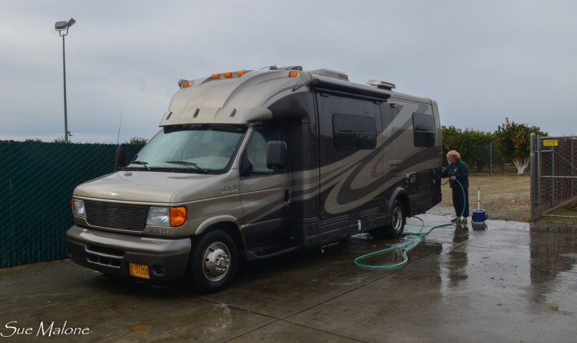
 We stopped for lunch somewhere along Highway 58 before Barstow, where Mattie got her first taste of desert air and we opened up the slide and let the sunshine pour in while we made a nice lunch and took a bit of a break. Mo drove the rest of the route, one of our favorites, from Barstow, down Highway 247, winding through the mountains down toward Yucca Valley and then down the big grade to Desert Hot Springs.
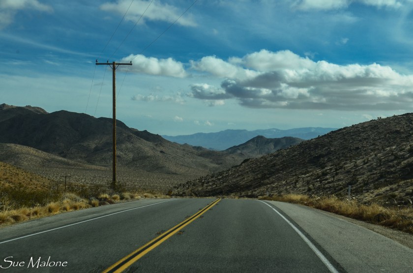 Every time we come here, I am reminded of the wild, craggy, rocky, mountainous land that makes up this part of Southern California. It is so incredibly rugged, twisted and tortured by all the tectonic activity, all the faults that folded and uplifted and shattered the landscape. The desert here is anything but flat and boring, it is a wild world and so beautiful.
