
I am really looking forward to putting up a new photo of something more delightful than the smoke I encountered last trip out. Tomorrow we head north to Spokane with an overnight along the Columbia River at the LePage campground along I-84 at the John Day dam. Been reading reviews and with my Golden Age Pass you surely can’t beat 8.50 a night with electricity. More to come as the adventure begins.
Author: kyotesue
Soil scientist/mapper working for 35 years in the wild lands of the West. I am now retired, enjoying my freedom to travel, to hike without a shovel and a pack, to knit and quilt and play, to play with photography and write stories about all of it.
Smoky weekend at Medicine Lake
 California was incredibly smoky this weekend. When I left home in Jamestown it was reasonably clear, but by the time I reached the interstate the smoke was thick and only got thicker as I drove north. Here is a photo of what I-5 looked like north of Corning. But I had a goal, and drove through all that smoke for 380 miles to reach this perfect little gem of a lake in northern California, where Mo was already camped with the MoHo.
http://findarticles.com/p/articles/mi_m1216/is_n3_v181/ai_6607000
Even Mt Shasta was invisible to me as I drove the usually magnificent McCloud HWY 89 to Harris Spring Road and the final 33 miles to the lake. Once I was there, and settled in, it was worth it. Mo arrived earlier in the week on  Wednesday afternoon, and managed to get a perfect spot right on the lake. Number 45. Each time we have camped here, we have been in the Hogue Campground, along the northern side of the lake, and each time we have managed a lake front site. It gets a bit more challenging with the bigger MoHo, but still at only 25.5 feet, she managed to slide in to this lovely site, and with a bit of additional leveling we had a perfect lake view, room for the awning between the trees, and amazing privacy, even though the campground was more than half full over the weekend. For bigger rigs, there are nice roomy level private sites farther uphill, but the lake view is well worth the juggling. We saw some fairly big rigs in these sites, easy and comfortable.
 Wednesday afternoon, and managed to get a perfect spot right on the lake. Number 45. Each time we have camped here, we have been in the Hogue Campground, along the northern side of the lake, and each time we have managed a lake front site. It gets a bit more challenging with the bigger MoHo, but still at only 25.5 feet, she managed to slide in to this lovely site, and with a bit of additional leveling we had a perfect lake view, room for the awning between the trees, and amazing privacy, even though the campground was more than half full over the weekend. For bigger rigs, there are nice roomy level private sites farther uphill, but the lake view is well worth the juggling. We saw some fairly big rigs in these sites, easy and comfortable.
 The best part about Medicine Lake is how uncrowded it is, even on sunny Saturday afternoons. The water is clear, and the lake rules allow speedboats between the hours of 10 and 5, so there are quiet times for kayaks and canoes and everyone is happy. We saw people doing lots of fishing, and one happy person said the fish were fairly easy to catch, they just jump on the hook when you put it out there. It is one of the few places that Mo and I really enjoy returning to when there are so many new places to visit. It’s clean and open and the camp spaces are far enough apart that most of the time it feels private and spacious. We take the boats down to the beach and leave them there for the entire visit, kayaking in the late evenings or early mornings when the winds are quiet. On this trip, there was more wind than usual, even early in the day, so our paddles were a bit restricted, and the air wasn’t as perfectly clear as it usually is, but even so, it was relaxing and a great way to spend a week, or a weekend. We hiked along the lake to the tiny little Medicine Lake and Abby thought the entire trip was just so that she could swim every day and often. Mo brought along plenty of firewood from home as well so we had some truly lovely roaring fires night and morning . Back to Jamestown Sunday evening, and just another week of work and a weekend to get ready for the Spokane trip. I can hardly wait, but in the meantime, the Medicine Lake trip was a wonderful respite from the daily dig.


Medicine Lake Highlands
 This is the lovely lake that awaits our next trip, nestled into the Medicine Lake Highlands of northern California. The serenity pictured here belies the rumble beneath the surface that may one day become part of the landscape. Geothermal energy is here, part of the very recent volcanic activity that created some of the magical features in this area, and it’s development is a controversial subject.
http://vulcan.wr.usgs.gov/Volcanoes/MedicineLake/Locale/framework.html
For now, here’s a photo of a quiet evening spent in 2006. I guess the campfire proves I am a true camper, or at least Mo is, since she is usually in charge of the fires. Recently, Laurie of the blog “Semi-True Tales of Our Life on the Road” http://laurieandodel.blogspot.com/ said one of the differences between fulltimers and campers is that fulltimers don’t build fires. Read her very funny story about campfires and mosquitoes and Odel in a sweat shirt at 78 degrees! I have never met either of them, but Laurie’s wonderfully descriptive sharing of their life on the road is a delight and an inspiration to me. I hope to one day be a full-timer as well, and will learn much from all that she has written.
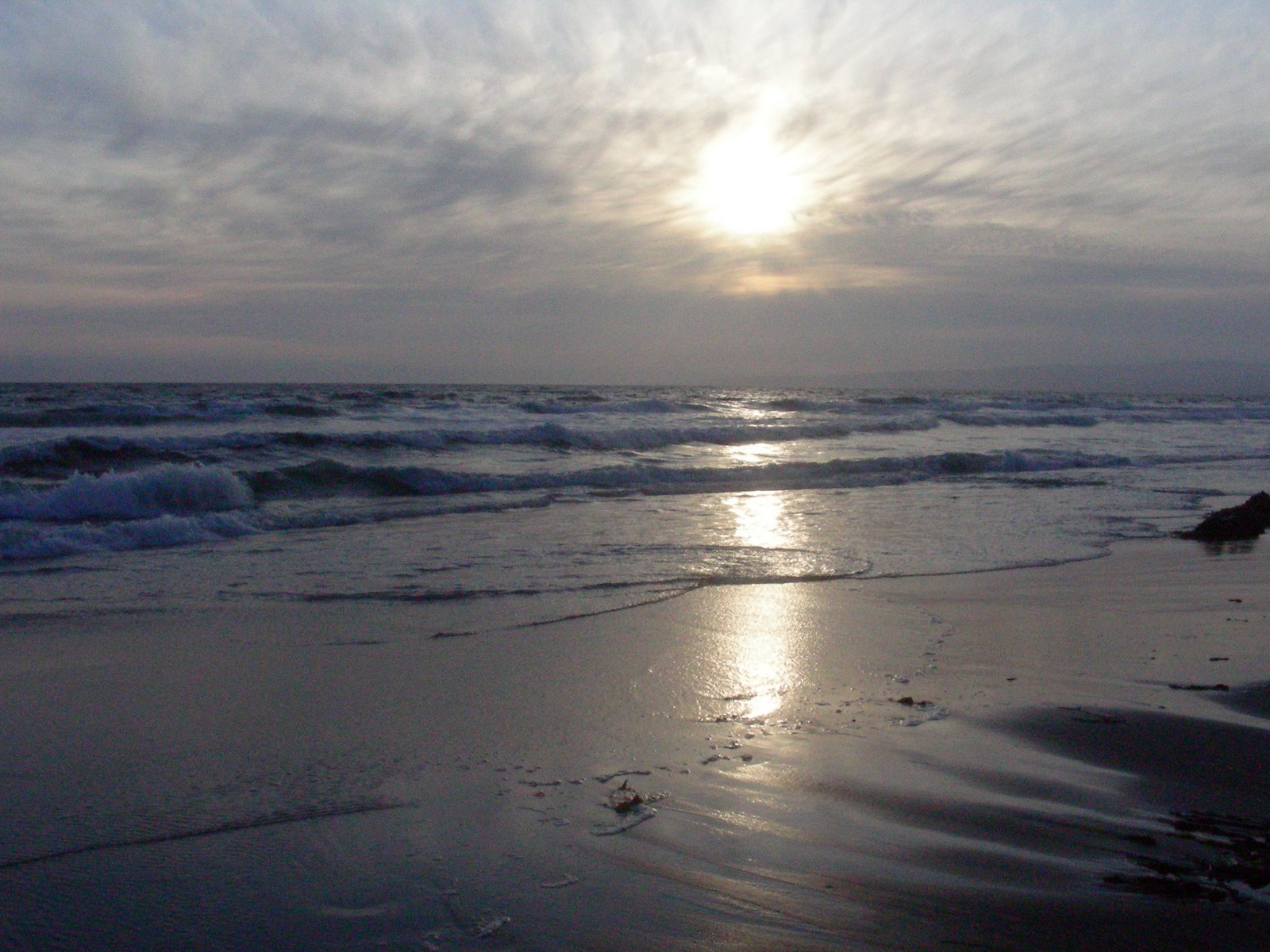
Sunset Beach and the Elkhorn Slough
 We planned this trip to the Elkhorn Slough some time ago, after reading about the restoration efforts there. http://www.elkhornslough.org/paddling.htm
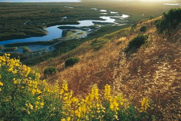 Our first estuary experience in South Carolina last December whetted our appetite for more of the same and we wanted to experience the Pacific version of this delightful way to be on the water. What I didn’t know before visiting is that the agency I work for, USDA-NRCS, has been working the Slough for several years, contributing the the restoration in many ways.
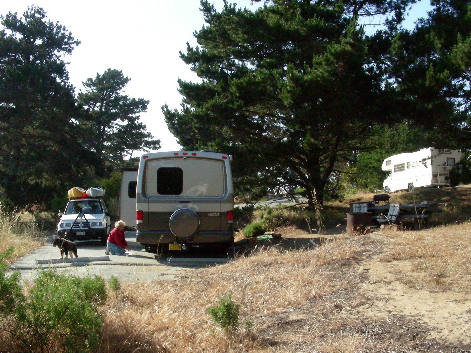
Choosing to travel the weekend after Memorial Day, we hoped that some of the crowds may have thinned a bit. What we didn’t plan for was cold winds and highs in the 50’s! Of course, Mo used to live near the coast, so she was more accepting of the cold weather than I was. Finding a place to camp near the beach is hard, and finding anyplace to camp actually ON the beach with a view of the water is even harder. We settled on Sunset Beach State Park, just west of Watsonville. It was about 10 miles north on HWY 1 from where we planned to do our boating beginning at Moss Landing.
We left Jamestown by 10 or so, and got to the beach by 3 in the afternoon. The drive to the coast is becoming familiar, but we do like to skip around some of the major roads and check out the side roads. This time we traveled down 101 from Gilroy, which smelled fabulously like it’s famous garlic, and crossed the coast range via historic HWY 129. I didn’t find any historic sites to speak of, so will have to ferret out the history at another time. What did become apparent as we got closer to Watsonville, however, was the incredible bounty of fruit that dominates this area in the spring. Cherries everywhere, and as we got closer to the coast, the cherry orchards gave way to vast fields of strawberries, brilliant red in their ripeness against the green leaves. They are grown on raised beds covered with plastic, and in some cases those beds look more than 2 feet high above the center rows. Farm workers were everywhere, harvesting, bent over picking, and the surprising thing was that there were so many cars all lined up near the fields, fairly nice cars actually. We only saw a couple of places that had the white farm labor buses for the workers transport. As we crawled though Watsonville, the traffic was slowed by long lines of semi’s waiting to be loaded, and small farm trucks piled high with empty strawberry crates heading back to the fields. I bought a flat of berries for making jam that were the size of small apples, and soft, ripe, and sweet as anything I have grown in my own garden.
The web site for the park discusses the fact that it is surrounded by agricultural land, and that our campground was in the dunes. I think somewhere in the fine print, it actually said there was n o view of the ocean. Not only could you not see the ocean, you couldn’t hear it either, and when we were relaxing by the fire, there was nothing to remind us we were at the ocean except the sand. The campground itself was nice, except I neglected to remember that there were no hookups. I am sure I must have known this when I made the reservation, but somehow I forgot, and as we looked around our space and realized we were drycamping, it was a silly moment. We had enough propane but our water tank was only 1/3 full, so Mo patiently carried gallon jugs of water and filled the tank with a funnel, while I put put away the DVD’s we brought for some light evening entertainment. No generator after 10 pm was the rule, and neither one of us is up to that kind of late hour for a movie! The other thing I hadn’t remembered is that Sunset Beach isn’t a dog friendly beach. We did read about the other state park just north allowin
 g dogs and stopped to verify that with the park ranger when we decided to go for an early evening beach walk with Abby. He was great, and told us that we could take her down the stairs to the beach that say “no dogs” if when we got to the actual beach we only walked north and not south where the snowy plover is nesting. That made our beach time a little bit easier, we only had to drive a 1/4 mile or so to get to the stairs. There was another set of stairs near our campsite, but they were high and steep, and the distance down to the beach on the ocean side was a bit daunting. Ever climb sand dunes??
 o view of the ocean. Not only could you not see the ocean, you couldn’t hear it either, and when we were relaxing by the fire, there was nothing to remind us we were at the ocean except the sand. The campground itself was nice, except I neglected to remember that there were no hookups. I am sure I must have known this when I made the reservation, but somehow I forgot, and as we looked around our space and realized we were drycamping, it was a silly moment. We had enough propane but our water tank was only 1/3 full, so Mo patiently carried gallon jugs of water and filled the tank with a funnel, while I put put away the DVD’s we brought for some light evening entertainment. No generator after 10 pm was the rule, and neither one of us is up to that kind of late hour for a movie! The other thing I hadn’t remembered is that Sunset Beach isn’t a dog friendly beach. We did read about the other state park just north allowin
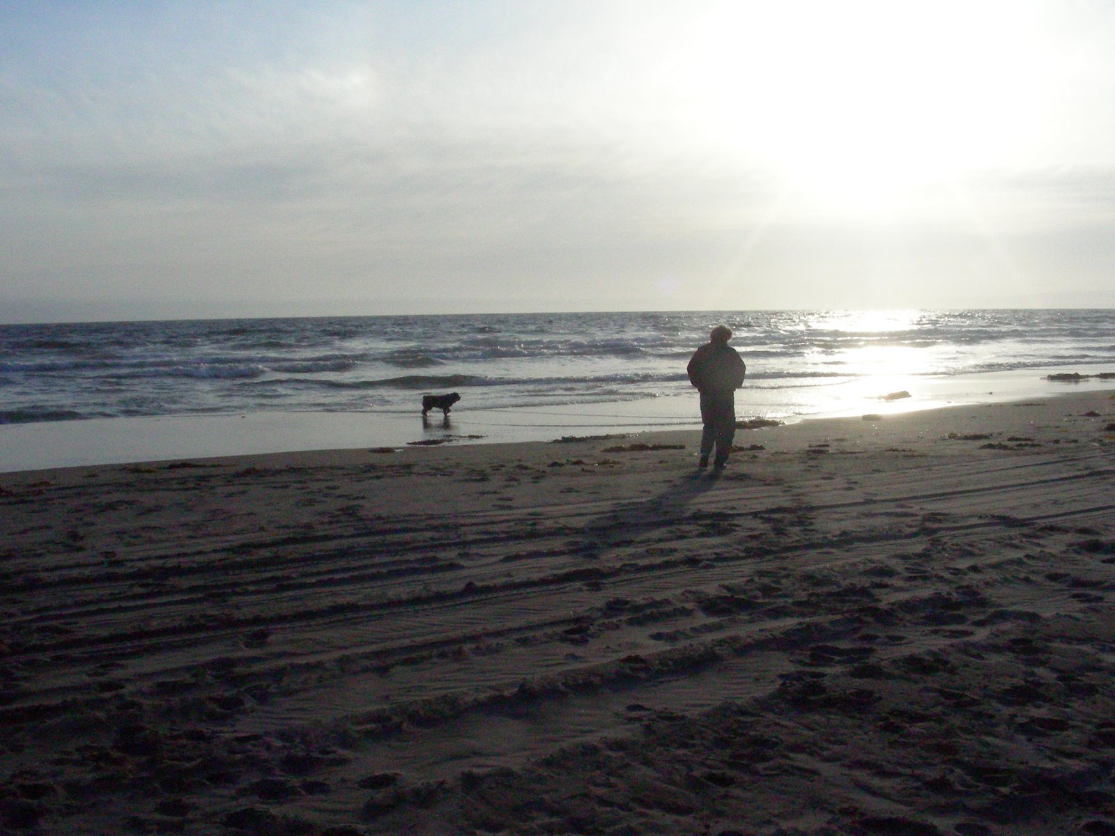 g dogs and stopped to verify that with the park ranger when we decided to go for an early evening beach walk with Abby. He was great, and told us that we could take her down the stairs to the beach that say “no dogs” if when we got to the actual beach we only walked north and not south where the snowy plover is nesting. That made our beach time a little bit easier, we only had to drive a 1/4 mile or so to get to the stairs. There was another set of stairs near our campsite, but they were high and steep, and the distance down to the beach on the ocean side was a bit daunting. Ever climb sand dunes??
 Whew! Another trail to an observation platform overlooking the ocean was closed for restoration of the fragile dune vegetation. We were grateful for the one beach where Abby could go, however, and managed long beach walks every day at one time or another.
The other surprise was the number of people in the campground, especially the number of children. I have never seen so many tents in my life in one place, and only after the weekend drew to a close did we discover that there was some kind of gathering going on, and when Sunday night rolled around everything got quiet and peaceful again, actually what we had originally expected. I still don’t know if that campground is always that full, but it was definitely full to bursting on Friday and Saturday. I was glad we had planned to be away during the day! We cooked steaks on the bbq for our first evening supper and it was great. Mo brought plenty of wood from Klamath so we had great fires morning and evening every day. The campfire pit was a big metal barrel, and at first we thought it wouldn’t be as good because we couldn’t see the fire, but later discovered how much heat that barrel puts out. With the previously mentioned cold and wind, that heat was very welcome! After walking around when the campground thinned out, we discovered a perfect campsite in the southernmost section, site number 25, on a hill with a view of the ocean. I would imagine that site would have to be reserved far in advance, because I think it is the only one with that view.
Reading the tide tables indicated that high tide would peak at 8:30 am. This meant that for our trip up the slough, we would have to be on the water 2 hours prior to that, and then we could come down with the outgoing tide.  Of course, on the coast, at the 530am wake up time, it is cold and damp and foggy. Not exactly the best weather to get out in a boat, but of course fishermen do it all the time. We drank warmed up coffee and headed for our put in site at the wharf in Moss Landing. It was really quiet there, with just a couple other people around, and no kayaks on the water at all. The put-in there was easy, though, with smooth level sand just a few feet from the road where we unloaded the kayaks. Into the water, and around past the dock and under the bridge and the adventure began. The animals were amazing. The dock was covered with sea lions, the harbor was filled with harbor seals, swimming all around us, and sea otters were everywhere, watching us with curiosity before they would roll over in the water and continue their feasting on
  whatever they were eating. I took this all for granted on this first trip out. I had read about Elkhorn Slough and the animals there, and expected to see otters and seals and lots of birdlife, so didn’t think this was at all unusual. All the way up the slough the otters were surrounding us, and there were water birds of all kinds. The brown pelicans we expected, but were especially delighted to see three of our old white pelican friends coming down the water. There were snowy egrets and great egrets, white herons and blue herons, many kinds of ducks and lots of cormorants. It was an amazing paddle. We went about 4.5 miles to Kirby Park, which we found out later is the only place boaters are allowed to get out anyway. Decided to save the rest of the slough for Sunday morning, and after a little rest on the beach, we headed back down.
  The tide was going out and it was a really easy paddle, with little wind. Still cloudy and foggy, but a bit of sun broke through eventually. The most surprising thing, however, was the much lower number of mammals on and in the water. Most of the seals were gone and we didn’t see any otters at all. We realized then that we had been especially lucky with all the viewings, and also were glad that the tide forced us to go so early. As we arrived back at the put-in, it seemed that the kayaker gates flooded open. There were large groups from the Montery Bay Kayak Co putting in, a dozen at a time, and the harbor was covered with lots of brightly colored boats and people learning how to paddle. Boy, we got out just in time!
 Of course, on the coast, at the 530am wake up time, it is cold and damp and foggy. Not exactly the best weather to get out in a boat, but of course fishermen do it all the time. We drank warmed up coffee and headed for our put in site at the wharf in Moss Landing. It was really quiet there, with just a couple other people around, and no kayaks on the water at all. The put-in there was easy, though, with smooth level sand just a few feet from the road where we unloaded the kayaks. Into the water, and around past the dock and under the bridge and the adventure began. The animals were amazing. The dock was covered with sea lions, the harbor was filled with harbor seals, swimming all around us, and sea otters were everywhere, watching us with curiosity before they would roll over in the water and continue their feasting on
 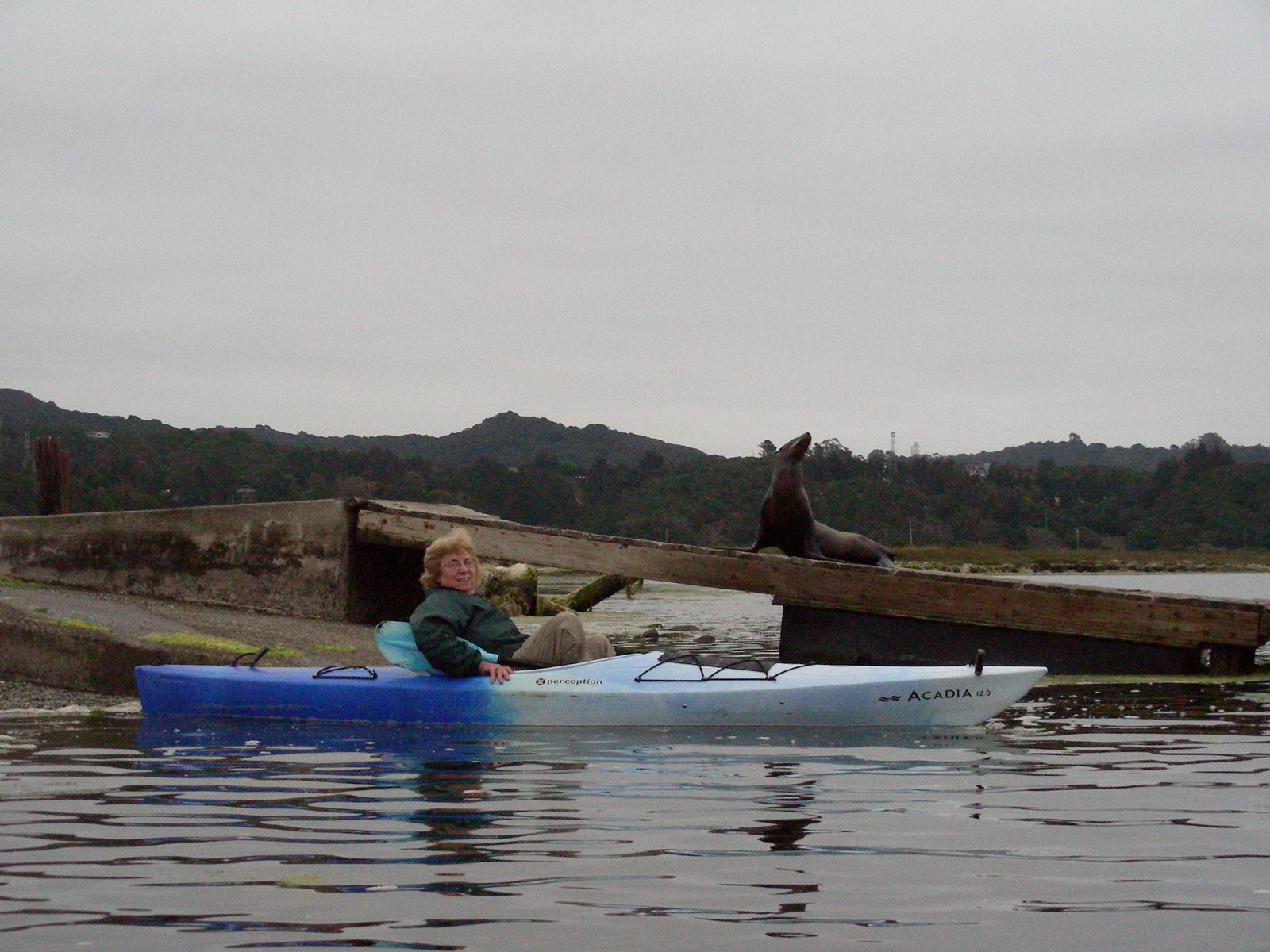 whatever they were eating. I took this all for granted on this first trip out. I had read about Elkhorn Slough and the animals there, and expected to see otters and seals and lots of birdlife, so didn’t think this was at all unusual. All the way up the slough the otters were surrounding us, and there were water birds of all kinds. The brown pelicans we expected, but were especially delighted to see three of our old white pelican friends coming down the water. There were snowy egrets and great egrets, white herons and blue herons, many kinds of ducks and lots of cormorants. It was an amazing paddle. We went about 4.5 miles to Kirby Park, which we found out later is the only place boaters are allowed to get out anyway. Decided to save the rest of the slough for Sunday morning, and after a little rest on the beach, we headed back down.
 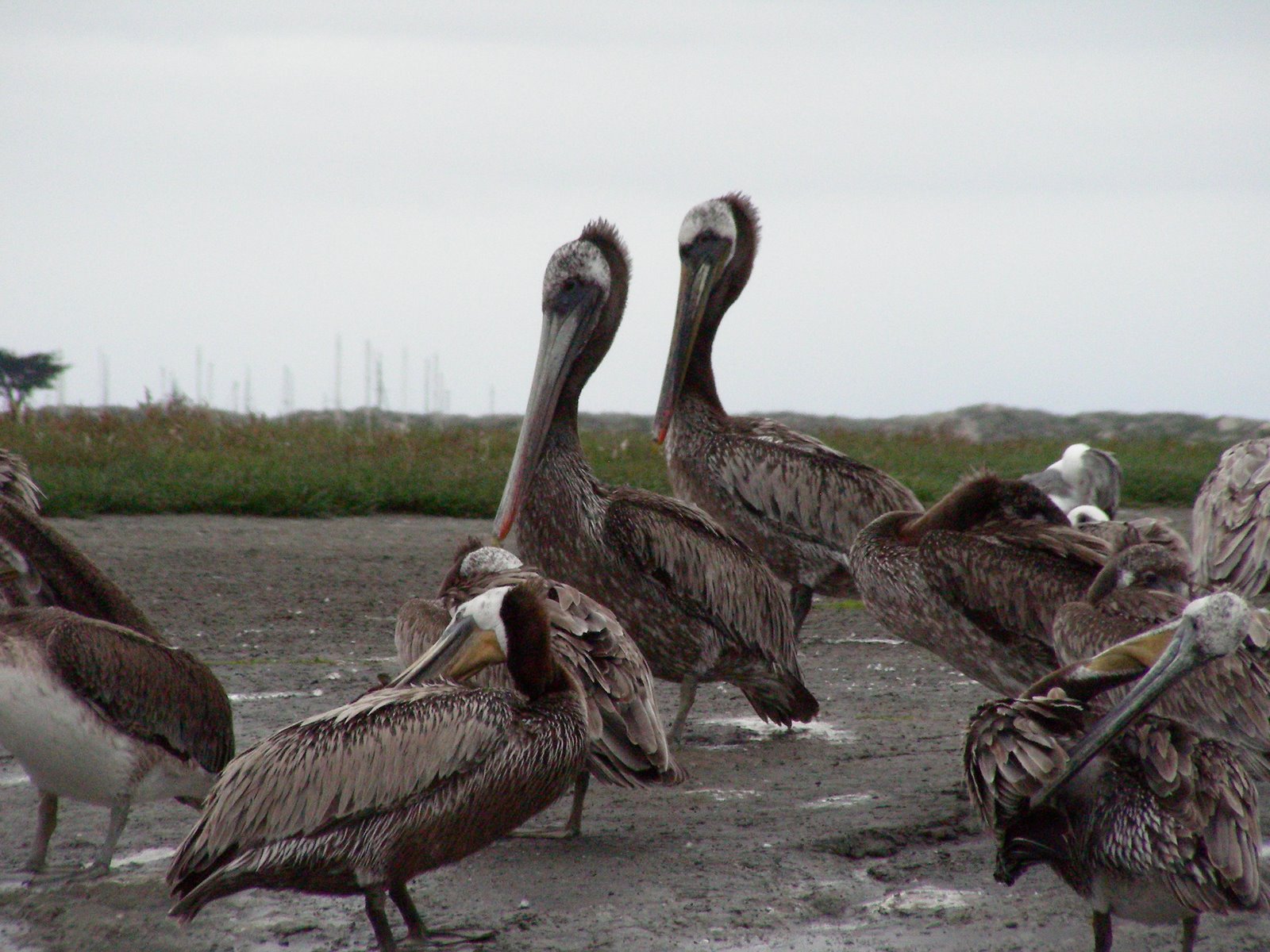 The tide was going out and it was a really easy paddle, with little wind. Still cloudy and foggy, but a bit of sun broke through eventually. The most surprising thing, however, was the much lower number of mammals on and in the water. Most of the seals were gone and we didn’t see any otters at all. We realized then that we had been especially lucky with all the viewings, and also were glad that the tide forced us to go so early. As we arrived back at the put-in, it seemed that the kayaker gates flooded open. There were large groups from the Montery Bay Kayak Co putting in, a dozen at a time, and the harbor was covered with lots of brightly colored boats and people learning how to paddle. Boy, we got out just in time!
 We spent the rest of the day enjoying our camp site, going for some walks, and exploring some of the roads around Watsonville, and visiting the Elkhorn Slough Headquarters. We even drove up to Santa Cruz to find gas that wasn’t 4.39 a gallon and were rewarded with 4.29 pg. Hmmm. How many miles was that??? We filled up the baby car so that if we needed to run the generator on the MoHo we could siphon some gas! ha!! might have been a good idea to remember we were dry-camping and have the gas tank full! Sunday morning we were both tired, and said, let’s wait till the afternoon tide, but then around 7 there was a break in the sky, and we decided to go for it. We drove the back road to Kirby Park, and this time continued up the slough to it’s end at the railroad bridge. We saw more pelicans, egrets, herons, and cormorants, but only one lonely harbor seal and no otters on this day. Another reason to be grateful for Saturday’s amazing experience.
 We had originally planned to go home and make a big breakfast, but decided instead to explore Moss Landing. Both of us were fairly hungry by this time so we thought, OK, change of plans, let’s find food! Phil’s Fish Market was the perfect choice, where we had wine and fish and chips and went for another lovely walk on the beach, this one much cleaner actually, with surfers and very few people still because of the cold strong winds.
 We had originally planned to go home and make a big breakfast, but decided instead to explore Moss Landing. Both of us were fairly hungry by this time so we thought, OK, change of plans, let’s find food! Phil’s Fish Market was the perfect choice, where we had wine and fish and chips and went for another lovely walk on the beach, this one much cleaner actually, with surfers and very few people still because of the cold strong winds.
 Home to a tremendously relaxing afternoon, even a real nap! Something I actually didn’t think I could do and instead I slept for a couple of hours. Amazing. We cooked our bacon and eggs and hash brown breakfast for a great dinner and then went for a walk up the dunes to watch the sunset. Another great night sleeping in the cool ocean air, a slow easy morning wake up, and we left for home around 10. Perfect timing to get back to the warm sunny Mother Lode hills by early afternoon. I’m not sure we will ever return to this place, since our list of to-do’s is pretty long, but it was a great experience.
Recreation Creek
 This is one of those “other traveling tales” that isn’t about traveling in the MoHo, but for travelers, this is a place worth talking about. I drove to Klamath this past weekend, where Mo lives just a short distance up the road from the most wonderful kayak/canoe trail that we have found yet. The MoHo is waiting patiently in Jamestown for our coming beach trip, and then she will return to Klamath with Mo for the summer. In the mean time, until I retire to this place next year, I drive more than 400 miles each way to have the chance to kayak on these pristine waters as often as I can.
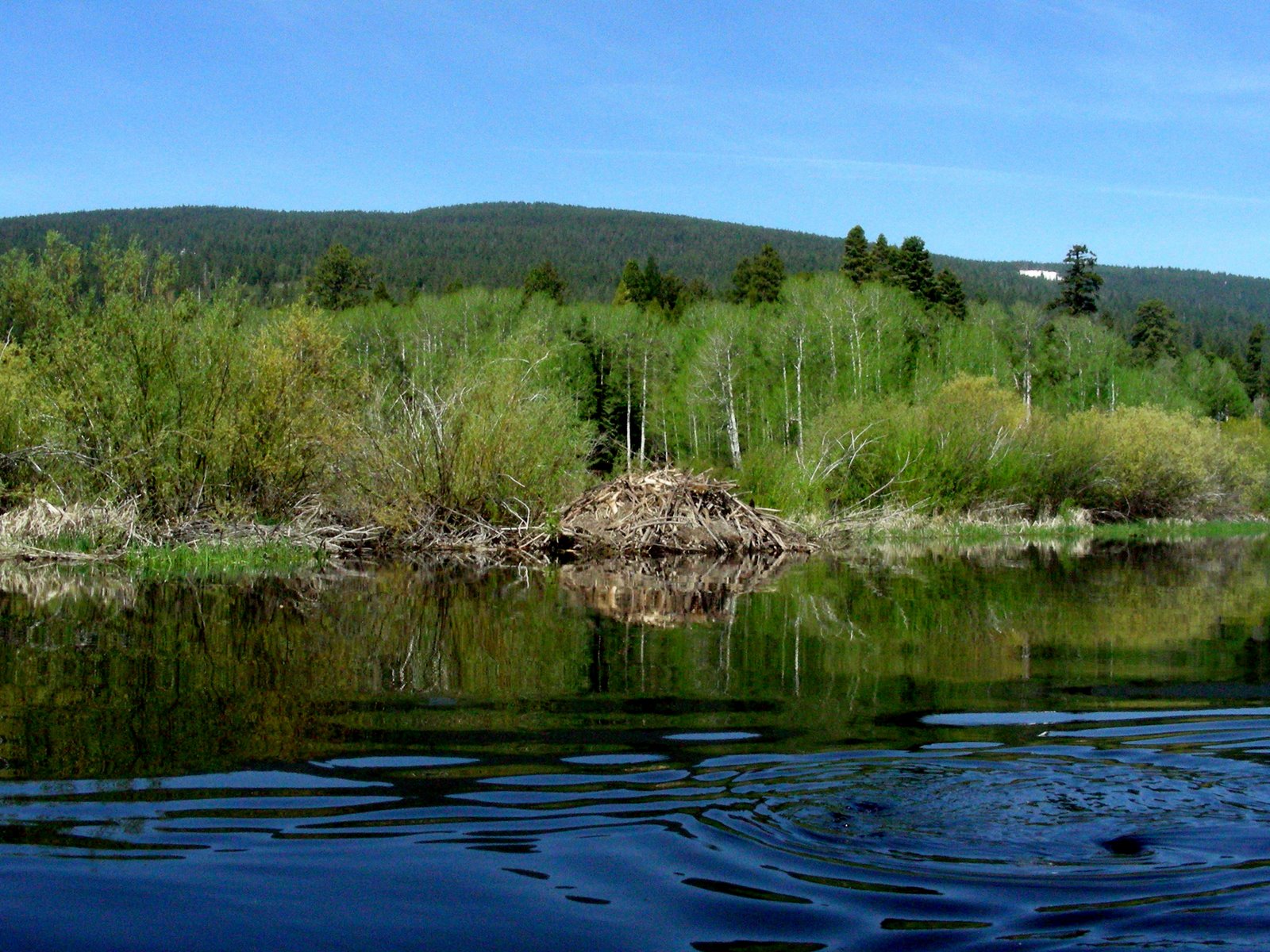
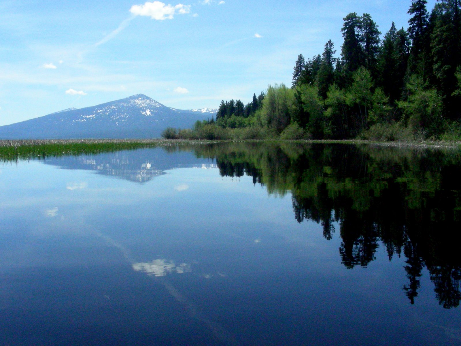
When the temperatures are hovering around 100 degrees in Central California, the cool nights of the mountains of Oregon are a respite worth the drive. Recreation Creek and Crystal Creek are on the western side of the Upper Klamath Wildlife Refuge. One of the highlights of my soils career was the opportunity to map the marsh soils in the 11,000 acre bird wonderland. The canoe trail is one of the best I know of, and the water is crystal clear from the input from meltwaters of the Cascade snow packs that feed the underground springs that feed the creeks and the wetlands.
We kayak this creek often, at different times of the year, and each time has surprises. The wetlands support tall bullrushes “tules“, that in summer make navigating without a GPS a daunting task, 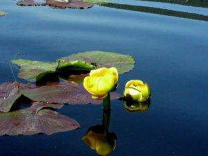 especially if you travel out into the marsh at all. But this year the spring came later, and the wocus flowers were just emerging and the tules were still brown and low so that nothing interrupted the views. We heard blue herons and sandhill cranes, saw lots of geese and ducks, willits, and red wing and yellow headed blackbirds. One of the best treats was watching a huge flock of white pelicans flying high over the marsh as they were arriving. I have never seen a flock this big before, and they were very high in the sky, circling and circling for a very long time. I thought maybe they were just arriving and trying to decide where to hang out for the springtime.
 especially if you travel out into the marsh at all. But this year the spring came later, and the wocus flowers were just emerging and the tules were still brown and low so that nothing interrupted the views. We heard blue herons and sandhill cranes, saw lots of geese and ducks, willits, and red wing and yellow headed blackbirds. One of the best treats was watching a huge flock of white pelicans flying high over the marsh as they were arriving. I have never seen a flock this big before, and they were very high in the sky, circling and circling for a very long time. I thought maybe they were just arriving and trying to decide where to hang out for the springtime.
 The beavers were especially active this year as well, and when we put our boats into the water  later in the evening on Sunday we were boating with beavers. Fun. Somewhat like our kayaking with dolphins in the lo country of South Carolina. There were at least 6 we think, all swimming along, very busy of course. The whap of their tails on the water is loud. I tried making my paddle do the same and watched the instant diving of the beaver that had been swimming along beside us nonchalantly.
 later in the evening on Sunday we were boating with beavers. Fun. Somewhat like our kayaking with dolphins in the lo country of South Carolina. There were at least 6 we think, all swimming along, very busy of course. The whap of their tails on the water is loud. I tried making my paddle do the same and watched the instant diving of the beaver that had been swimming along beside us nonchalantly.
If you love to kayak on quiet fresh water, don’t miss this experience. The channel of the creek is deep and dark, bounded on the east by the fresh water wetlands of the marsh and on the west by the high ridge of the eastern Cascades. Mt McLaughlin, Harriman Peak, Pelican Butte all are visible rising above the steep front beside the stream. In the north are the peaks that surround Crater Lake, the Watchman and Mt Scott, covered with snow. Two wilderness areas are visible as well, the Sky Lakes Wilderness and the Mountain Lakes Wilderness. It’s a place that rivals any I have ever experienced. 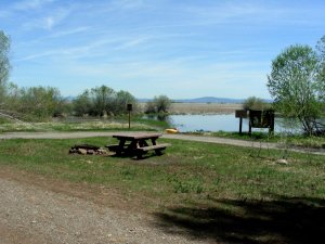 I have added the link for the canoe trail and another one for the birding trail that is here as well. If you are anywhere near Klamath and if you love to kayak or canoe, it’s a treat not to be missed.
 I have added the link for the canoe trail and another one for the birding trail that is here as well. If you are anywhere near Klamath and if you love to kayak or canoe, it’s a treat not to be missed.
Malone Springs is just off the West Side Road a few miles north of Rocky Point. It’s free boondocking, with a narrow gravel road that could still accomodate a motorhome and a large turn around area with a couple of camp sites right at the springs. Be ready for mosquitos, however, but it’s a beautiful spot. Of course, there is always the Rocky Point Resort for good food and camping as well, with space for RV’s, We launch either here at Rocky Point or at Malone Springs for the trip north to Crystal Springs, another deep velvet green wonderland spring. ahh, Oregon, how I love you.
All these places are listed as part of the itinerary for the volcanic scenic byway that includes Crater Lake. http://www.byways.org/explore/byways/2587/itinerary/4034

If the photos have inspired you to look further, check out the Recreation Creek album on my Picassa website. The link is at the top of this blog page.
